BLOG
April 28th, 2014
Via RAND Corporation, a detailed look at implications of climate change on water supplies & management in the United States’ southwest:

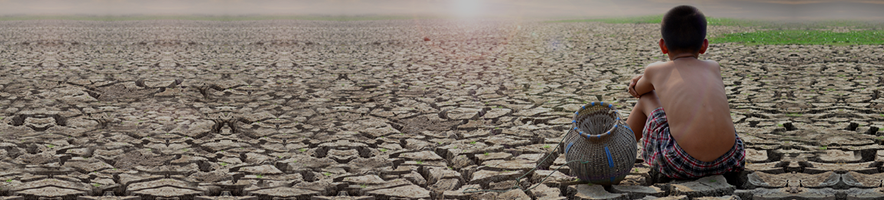
Droughts across the western United States have left water managers worried like never before. The Colorado River and its reservoirs, upon which seven states rely, are being depleted by 14 years of drought nearly unrivaled in 1,250 years. In California, 2013 marked the driest calendar year in 119 years of recordkeeping, and the January 2014 snowpack matched that of January 2012 as the driest on record for that month. While water managers have been concerned for years about drier times in the future, today’s conditions suggest that the future is now.
Climate change and its implications remain the great unknowns, but water managers do not have the luxury of waiting for all the facts to come in before they must prepare for them. For this reason, water agency managers from all seven states in the Colorado River Basin, along with federal water managers from the U.S. Bureau of Reclamation, have been trying to gauge the Colorado River system’s reliability — or its capacity for meeting the region’s water needs over the next 50 years — and to weigh the options for managing the river’s resources in an age of climatic uncertainty.
A RAND team, working with the federal managers and state water officials, has found that water deliveries will likely become threatened throughout the river basin in the future if the situation becomes only a bit worse, with stream flows falling still further below historical averages and severely dry conditions (drier than those of the past 14 years) persisting for eight years or more. An analysis of several portfolios of options has identified municipal, industrial, and agricultural conservation as high-priority measures that should be implemented soon in any case.
In California, another RAND team has tested the long-term plans of the El Dorado Irrigation District, which is the water agency for El Dorado County, located in the Sierra Nevada mountains. The district’s water system appears to be highly reliable under standard operating assumptions; but again, the RAND team found that major vulnerabilities could arise under climate change and other plausible circumstances related to new supplies. Some of these vulnerabilities could be mitigated by greater water-use efficiency in the increasingly suburban, western part of the district coupled with additional surface water storage in the highly mountainous east.
In both studies, the RAND teams considered the best-case futures, the worst-case futures, and many futures in between. The optimal strategies for managing water along the Colorado River and in the Sierra Nevada varied depending on assumptions about the future, the location, and other variables. But a few strategies stood out as helpful across the board.
Given the uncertainties about climate change and other water supply factors, designing a management strategy to perform optimally for a single forecast of future conditions is not very useful. Rather, planners need strategies that are robust and adaptive — robust in that they perform well over a wide range of possible futures and adaptive in that they can be adjusted over time in response to evolving conditions. These are precisely the kinds of water strategies that RAND methods can help identify. RAND’s recent work helping water agencies develop robust, long-term water plans has become more crucial than ever.
The Colorado River
The Colorado River is the single most important source of water in the southwestern United States, providing water and power for nearly 40 million people, including 22 Native American tribes, and for irrigating more than 5 million acres of farmland that grow 15 percent of U.S. crops. The river supports billions of dollars of economic activity and is also the lifeline for two dozen national parks, wildlife refuges, and recreation areas.
Water from the river is apportioned to the seven Colorado River Basin states and adjacent areas according to a series of federal laws and agreements dating back to the Colorado River Compact of 1922. In that year, based on two decades of unusually high river flow, the compact negotiators believed the average flow of the river to be about 16.4 million acre-feet per year. As a result, the compact initially allocated 15 million acre-feet of water annually, splitting it equally between the Upper Basin States (Colorado, New Mexico, Utah, and Wyoming) and the Lower Basin States (Arizona, California, and Nevada). To this day, each basin is entitled to consume 7.5 million acre-feet per year.
More recently, however, it has become evident that the average long-term flow is less than once assumed. Based on tree-ring data gathered over the past 30 years, modern reconstructions of flows from the paleoclimatological record (the time periods prior to direct measurements) suggest that the average flow over the span of more than a thousand years has been only 13.5 to 14.7 million acre-feet per year.
The average long-term flow is less than once assumed.
Despite the gap between the initial compact allocations and the lower historical supplies, there has never been a large-scale water delivery shortage for Lower Basin users, for two reasons. First, the Upper Basin states (shown in Figure 1) have never used their full share of water. Consumption in the Upper Basin has grown, but it still reached only 3.8 million acre-feet in 2010. Because the U.S. Secretary of the Interior can redistribute water that goes unused in any given year, the unused water in the Upper Basin has been available for redistribution to the Lower Basin, where states have in the past requested more water than initially allocated. Second, the river has about 65 million acre-feet of storage capacity in Lakes Powell and Mead and other reservoirs. When full, the reservoirs could meet roughly four years of demand even without new streamflow. For nearly 80 years, water from these reservoirs has prevented shortages even during extended drought periods.
Figure 1 — Since 1922, the Upper and Lower Colorado River Basins Have Been Allocated Equal Amounts of Water
SOURCE: Colorado River Basin Water Supply and Demand Study: Study Report, U.S. Department of the Interior, Bureau of Reclamation, December 2012.
Today, however, a growing body of literature — as well as the recent conditions over the past 14 years — suggests that the Colorado River has entered a new hydrologic era for which past data and experience are poor guides for the future. Climate simulations are generally consistent in predicting that the entire river basin will track global trends and become warmer, with increases in average annual surface temperatures of 1.0 to 1.5 degrees Celsius by 2025 and 2.5 to 4.0 degrees Celsius by 2080, relative to the 1971–2000 average. A warming climate, fueled by the global accumulation of greenhouse gases in the atmosphere, is expected to reduce the snowpack, shift the timing of snowmelt and runoff earlier in the year, and raise the overall demand for water.
Investing in River Basin Reliability
In a project for representatives of all seven states and for the U.S. Bureau of Reclamation, the federal agency that oversees water resource management for the U.S. Department of the Interior, a RAND team helped to lay the groundwork for new investments in water supplies and water-use efficiency for the Colorado River Basin. Working with the federal managers, the RAND team compiled a large set of potential “futures” of water supply, water demand, and reservoir operations. Each future represented one way that these three factors could unfold throughout the 49-year period from 2012 to 2060. All told, the research team generated 23,508 futures.
To compare the results across the futures, the team focused on two key performance metrics for water delivery: Lee Ferry deficit and Lake Mead Pool elevation. These metrics broadly summarize the reliability of the Upper Basin and Lower Basin, respectively.
Lee Ferry, a site on the Colorado River in Arizona, is considered the dividing line between the Upper and Lower Basins. In the futures evaluated by RAND, a Lee Ferry deficit occurs in the Upper Basin whenever the running ten-year sum of flows past Lee Ferry falls below 75 million acre-feet. Such depletion has never occurred, but it could require that deliveries to the Upper Basin be curtailed to augment flows to the Lower Basin.
Deliveries to the Lower Basin are similarly dependent on the Lake Mead elevation. In the futures evaluated, the reliability goal for the Lower Basin is not met at any time in which the Lake Mead reservoir level drops below 1,000 feet. In reality, dropping below this threshold could be catastrophic: If Lake Mead were to fall below 1,000 feet, then the Southern Nevada Water Authority could no longer tap its water supply, and Las Vegas would lose the majority of its water.
The project partners assembled four portfolios of options to mitigate the reliability shortfalls. Each portfolio consisted of two to three dozen policy options, ranging from conservation to desalination and from increasing water efficiency to importing water into the basin through new conveyance facilities. All four portfolios reduced the number of years in which the river system would likely fail to meet water delivery goals.
Two of the portfolios showcased some significant tradeoffs between the Upper and Lower Basins. The first portfolio focused on reliability of water deliveries; the second, on environmental performance. The main difference between the two is that the former included more desalination and imported supplies, whereas the latter included an Upper Basin water bank to store excess water in wet years and more watershed management, such as brush control.
The comparative outcomes became most apparent when considering the most stressing conditions associated with climate change. These conditions correspond to long-term average natural flows (flows absent human use or management) falling below 13.8 million acre-feet per year at a flow gauge located at Lees Ferry, Arizona, coupled with eight consecutive drought years during which these flows fall to 11.2 million acre-feet. (The U.S. Geological Survey flow gauge at Lees Ferry, Arizona, is situated slightly upstream from Lee Ferry, which is the separate location used to track flows from the Upper Basin to the Lower Basin for purposes of administering the Colorado River Compact.) This set of stressing conditions has not been observed over the past 100 years, but it can be found in droughts in the paleohistorical record.
Under this set of conditions, and in the absence of new investments in river basin reliability, there would likely be Lee Ferry deficits in 18 percent of the years to come (see Figure 2). The reliability portfolio would reduce the incidence of such deficits to 8 percent of future years. The environmental performance portfolio would cut the incidence further to just 5 percent. Thus, for the Upper Basin, the environmental portfolio would be more effective.
Figure 2 — Under Conditions of Climate Change, the Environmental Portfolio Would Work Better for the Upper Basin; the Reliability Portfolio, for the Lower
SOURCE: Adapting to a Changing Colorado River, 2013.
The reliability portfolio, however, would be more effective in preventing Lake Mead levels from dropping to critically low levels (below 1,000 feet). Without any new investments in river basin reliability, Lake Mead would drop below this threshold in 50 percent of the years associated with the dry conditions described above. Implementing the reliability portfolio would limit these unacceptably low lake levels to 21 percent of the years; the environmental portfolio would reduce them to 26 percent. Thus, for the Lower Basin, the reliability portfolio would work better.
But the environmental portfolio would cost less. In 2060, it would cost about 15 percent less per year than the reliability portfolio, depending on the future. For the Upper Basin, the environmental portfolio would perform better and at a lower cost because it includes the water bank, which would maintain flow to the Lower Basin at Lee Ferry, and excludes other, more expensive new supply options. But for the Lower Basin, the reliability portfolio would perform better because it includes more options, such as Pacific Ocean desalination projects, which directly benefit the Lower Basin.
The four portfolios studied represent only a few of many possible investment paths. Therefore, this early analysis cannot be considered sufficient for choosing which investments to make and when — let alone for choosing one portfolio for the benefit of one basin over another portfolio for the benefit of the other.
Conservation should begin soon, no matter what.
Nonetheless, the study did conclude that conservation should begin soon, no matter what. More than 90 percent of all 23,508 futures indicated that additional water conservation is necessary now in the municipal and industrial sectors throughout the Upper and Lower Basins. Nearly 100 percent of the futures showed that additional agricultural conservation, combined with water transfers between the basins, should take effect in the next five years. In other words, no matter how dry it gets in the future, conserving water sooner will almost always help later. Within a decade, it will also likely become necessary to start planning for desalination projects — for ocean water, agricultural drainwater, and brackish groundwater.
Water managers need not commit to all possible options now, but they should use the available lead-time for preparing to invest in new options if conditions suggest they are warranted. The U.S. Bureau of Reclamation and the state agencies are working to collect information on current conservation efforts and irrigation practices to help determine how to best implement new conservation measures. Some agencies, such as the Southern Nevada Water Authority, are making costly investments in their infrastructures to enable them to receive water from Lake Mead even if its level drops below 1,000 feet. Over the next few years, it may also be easier to discern whether the future climate is going to continue to deviate from the historical record — particularly if the current drought persists.
The Sierra Nevada
Local water agencies have always faced uncertainty in making plans and building infrastructure. Today’s agencies regularly use computer models to simulate future water supply, demand, and infrastructure needs. But the agencies also now need to evaluate how plausible changes in climate and other factors could disrupt their best-laid plans, how those plans could be adapted in response, and how those adaptations could involve key tradeoffs. In a simplified version of the Colorado River study described above, a RAND team showed how one local water agency in California could judiciously adapt its plans to account for climate change — and how other local agencies could potentially do the same.
Water agencies need to evaluate how changes in climate and other factors could disrupt their best-laid plans.
The El Dorado Irrigation District lies within El Dorado County, which climbs the western slope of the Sierra Nevada mountains, extending from the eastern suburbs of Sacramento to the southern shores of Lake Tahoe (see Figure 3). The western end of the district has grown increasingly suburbanized. In the mountainous eastern end, winter snowfall and spring and summer snowmelt constitute important elements of the regional hydrology. Between these two extremes, the county’s rivers run through deep, picturesque canyons, where whitewater rafting, kayaking, and cold-water fishing are common and valued for both aesthetic and economic reasons. El Dorado County also includes important agricultural regions where fruit tree orchards and vineyards generate economic value. Single-family residential customers represent roughly 67 percent of total annual water demand, while agricultural users account for 14 percent. The district expects a continued shift from agricultural to urban water use. The district today serves more than 100,000 people.
Figure 3 — El Dorado Irrigation District Extends from the Eastern Suburbs of Sacramento to the Southern Shores of Lake Tahoe
SOURCE: El Dorado Irrigation District.
The district faces many of the same challenges facing other water utilities in the western United States: growing population, limited new local supply options, potential reductions in supplies due to climate change, and the risk of large wildfires. The district has several opportunities for addressing these challenges, and its current master plan has already identified the possibilities of increasing water-use efficiency, acquiring new supplies from a neighboring water agency, and constructing a new reservoir.
For a baseline estimate of the district’s future capacity, RAND researchers simulated this capacity through 2050 under historical climate conditions and, beginning in 2020, with access to additional, anticipated water supplies from the Upper American River Project, a series of dams, reservoirs, and hydropower plants owned and operated by the Sacramento Municipal Utility District. Under these favorable baseline assumptions, the El Dorado Irrigation District’s current plan appears to be 100-percent reliable in the western region and 94-percent reliable in the eastern region for the decades between 2020 and 2050.
The researchers next explored how well the current plan would fare under different but reasonable assumptions. In total, there were 52 alternative futures, which varied according to 13 different climate projections, two household growth rates, and either the availability or unavailability of the expected additional external supplies from the neighboring Sacramento utility.
The western region of the El Dorado Irrigation District faced no vulnerabilities in any of the futures that included the additional external supplies. But in many of the other alternative futures, the reliability for both regions in the district was substantially degraded. Without the additional external supplies, the most stressing future slashed reliability to about 10 percent in the west and 0 percent in the east, while the most favorable climate and demand assumptions allowed reliability to exceed only 75 percent in the west and 45 percent in the east. Even with the additional external supplies, reliability in the east remained highly sensitive to climate and growth assumptions.
Thus, the western region appears vulnerable primarily to the availability of additional external supplies, regardless of climate and growth rates. The eastern region appears vulnerable even with those added supplies. These outcomes are associated with climate conditions that are only slightly drier than those in the historical record, with precipitation declines of just 3 percent below average. The outcomes suggest that climate uncertainty is more critical than demographic uncertainty in determining the success of the district’s plans.
The RAND team then applied three policy strategies to each of the 52 alternative futures. The first strategy was a 20-percent increase in water efficiency by 2020 relative to 2005, consistent with the 20×2020 Water Conservation Plan enacted by California in 2007. The second was to construct the Alder Reservoir in the district’s eastern region. The third was to do both.
The first strategy, increasing efficiency, proved helpful in both regions: in the west when the additional external supplies were not available, and in the east when they were available (see Figure 4). In the west, no less than 100 percent of the simulated futures became vulnerable to water shortages once the region was deprived of the additional external supplies, but increasing efficiency alone pared those vulnerable futures to 77 percent. In the east, the vulnerability rate plummeted from 69 percent to 23 percent when efficiency was increased in addition to the additional external supplies being tapped.
Figure 4 — In El Dorado County, Increasing Water-Use Efficiency Would Reduce Vulnerabilities in Both Regions
SOURCE: Addressing Climate Change in Local Water Agency Plans, 2013.
Constructing the Alder Reservoir alone did nothing to reduce vulnerabilities in the west but did alleviate matters in the east as long as the additional external supplies were available first. Pursuing both efficiency and the Alder reservoir reduced vulnerabilities further in the west when the additional external supplies were not available and in the east when they were. However, pursuing both strategies still left the east vulnerable 100 percent of the time without the additional external supplies.
The more likely these dire conditions are expected to be, the more prudent the additional investments would be.
The strategy of increased efficiency would entail less cost while reducing vulnerability more than the Alder Reservoir. Therefore, the reservoir should be developed only after efficiency is increased. While implementing neither additional strategy would save money, it would lead to the most vulnerability. The dual strategy of increasing efficiency and building the reservoir would entail substantial cost but lead to the least vulnerability.
These results validate the importance of the additional external supplies that the district is now seeking. They also underscore the importance of increased efficiency, especially for the eastern region under conditions of climate change. How much investment is needed in conservation or in a new reservoir depends on the likelihood that the water district ascribes to losing the anticipated, additional external supplies or drawing only 97 percent or less of average precipitation in the future. The more likely these dire conditions are expected to be, the more prudent the additional investments would be. A robust, adaptive strategy would therefore include monitoring not only the progress of obtaining new supplies from the Upper American River Project but also the climate trends and precipitation forecasts for the district.
Planning for a Wide Range of Futures
Specific investments today would improve outcomes across a wide range of plausible futures.
For the Colorado River, the U.S. Bureau of Reclamation commissioned an immense study of tens of thousands of simulated futures, pointing to vulnerabilities and adaptation strategies for the seven states in the river basin. The smaller study for the El Dorado Irrigation District, consisting of just a couple hundred futures, showed how this approach could be applied as part of routine, long-term planning studies by local agencies with more modest means. The smaller study also underscored the importance of considering climate change in local plans, something that is not yet ordinarily done.
In both the RAND studies described here, the water management strategy deemed most optimal today would perform disastrously in some uncertain, but plausible, futures. The analyses showed, however, that specific investments today would improve outcomes across a wide range of plausible futures and would represent important hedges for the water agencies. These are the preferred strategies for uncertain times. With the severe drought conditions facing the western United States today, now could be just the time to begin implementing more robust water management strategies such as these.
