The Colorado River is in crisis. The problem has been building for decades but has come to a head in recent years because the major manufactured reservoirs on the river have fallen to dangerously low levels, prompting the Biden administration to call for unprecedented cuts in water usage among the 40 million people who rely on the river.
That is forcing tough decisions out West. How do you balance securing water for some of the fastest growing cities in the country with preserving water for farming regions that supply most of the country’s winter vegetables? Do you recognize that some users have a longer established right to the water than others, such as farming regions that laid legal claim to the water before urban areas?Six of the seven states along the Colorado River have agreed to an approach for cuts that would get them close to what the Biden administration is calling for — but California, the biggest water user along the river, remains the lone holdout, leaving officials in the West worried about conflicting plans.
As the country starts to pay more attention to the plight of the Colorado River, we addressed some questions about the river and how its highly coveted water is distributed.
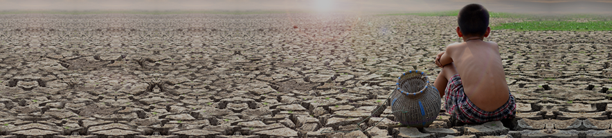
Why is the Colorado River drying up?The Colorado River is drying up due to a combination of chronic overuse of water resources and a historic drought. The dry period has lasted more than two decades, spurred by a warming climate primarily due to humans burning fossil fuels. These hotter and drier conditions in the western United States have drained the major artificial reservoirs on the river — Lake Powell on the Arizona-Utah border and Lake Mead on the Arizona-Nevada border — to levels not seen since these reservoirs were first filled decades ago.
In 1999, the year before the drought started, those two lakes together held 47.6 million acre-feet of water — that’s about 92 percent full. This week, they held a combined 12.9 million acre-feet of water, or about one-quarter full. An acre-foot is equal to 326,000 gallons of water, about as much as two to three typical households would use in a year.
The amount of water being used by the seven western states and Mexico far exceeds how much water is running through the river, James Prairie, the Colorado River’s research and modeling group chief at the Bureau of Reclamation, explained in a presentation in Las Vegas in December. Between 2000 and 2020, the natural flow of the Colorado River averaged 13.4 million acre-feet. In that same period, water consumption averaged 15 million acre-feet. Since the drought started, water use has outstripped supply by 33.6 million acre-feet.
“These reservoirs have served us for 23 years but we’re now pushing them to their limits,” Prairie said.
One of the most frightening dynamics playing out in the last few years is the changing relationship between snowpack in the mountains and runoff into the reservoirs. Last year was a decent snow year, about 90 percent of the normal amount of snow fell, but only about 60 percent of normal runoff reached the reservoirs. In 2021, things were even worse: another 90 percent snow year resulted in 29 percent of average runoff.
Scientists attribute this breakdown to climate change — the hotter and drier conditions now permeating the West. Drier soils absorb more water before it can reach the lakes. Hotter temperatures evaporate more water and lengthen the growing season for plants, sucking up more water.
How many states does the Colorado River run through?The Colorado River runs through seven states. It starts as little streams in Colorado’s Rocky Mountains (and is also fed by tributaries originating in Wyoming) and wends its way south and west for 1,450 miles until it ends in Mexico’s Sea of Cortez. The water is divided among what are known as the “Upper Basin” states: Colorado, Wyoming, Utah and New Mexico; and the “Lower Basin” states: California, Arizona and Nevada.
The Upper Basin states have fewer reservoirs, and water gets diverted from the river in thousands of places to serve farms and other users. The Upper Basin has to adapt its usage more to wet and dry years.
The Lower Basin states regulate their water deliveries every year from massive reservoirs, in particular Lake Powell and Lake Mead. If water levels fall too low in these reservoirs, they could reach “dead pool.” That’s the point when water would be effectively blocked from passing Glen Canyon Dam (on Lake Powell) and Hoover Dam (on Lake Mead) — cutting off the lifeline to some 25 million people who get water from Lake Mead.
What are water rights?Water rights on the Colorado River refer to who has access to take water out. They are based on seniority and governed through a complicated network of laws, court decisions, contracts and regulations known as the Law of the River.
There have been some important milestones for these rights over the past century.
Access to the river’s water was divided among these seven states in 1922, in an agreement known as the Colorado River Compact. Two decades later, in 1944, Mexico was guaranteed a portion of the river by treaty. These agreements grant a total of 17.5 million acre-feet of water to be shared between the states and Mexico. But the river’s natural flow has been far less than that in recent years.
In 1963, a Supreme Court case, Arizona v. California, ruled that of the first 7.5 million acre-feet that heads to the Lower Basin states, 4.4 million goes to California, while Arizona gets 2.8 million and Nevada gets 300,000.
Five years later, in 1968, the federal government agreed to build the Central Arizona Project, a network of canals that transport Colorado River water through Arizona. In exchange, Arizona agreed to junior water rights, so California would get its share of water before Arizona in times of shortage.
Times like right now.