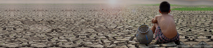
Struggling Over Water, Losing It Through Evaporation: The Case of Afghanistan and Iran January 30th, 2025
The long-standing water conflict between Iran (downstream) and Afghanistan (upstream) led to the 1973 Helmand Water Treaty, ensuring Iran a share of the Helmand River. However, prolonged #droughts and rising water demand are intensifying disputes with tensions reaching alarming levels. While both nations have built reservoirs to mitigate water shortages, evaporative losses from these reservoirs significantly reduce their effectiveness—a critical issue that often goes unmonitored.
In this latest study, Hannes Nevermann, Kaveh Madani, Matteo Zampieri, and Ibrahim Hoteit quantified evaporation from major reservoirs in the Helmand Basin, revealing a staggering 284 million cubic meters of evaporative water loss in 2023 alone—with the largest share lost coming from Iran’s ChahNimeh reservoirs. To put this into perspective, this loss exceeds one-third of Iran’s allocated share (820 MCM) under the 1973 treaty. Even more striking, 92% of this evaporated water precipitates outside the Helmand Basin, benefiting India, Pakistan, Afghanistan, and China the most. Despite Iran’s Chah Nimeh reservoirs contributing the majority of evaporated water, less than 1% of it returns as precipitation within Iran!
Simply speaking, not only a significant portion of water stored in major reservoirs in Hemand basin is lost to evaporation, but most of it does not return to the basin due to precipitation occurring outside the basin—highlighting the need for better water intelligence and transboundary cooperation.
Highlights
•
Evaporative water losses from major reservoirs in transboundary Helmand basin, shared by Afghanistan and Iran, are quantified.
•
A significant portion of the water evaporated from these reservoirs is transported and then precipitates outside the Helmand Basin.
•
A real-world example of how data analytics, remote sensing and modelling, can support water diplomacy and conflict resolution in transboundary basins is shown.
Abstract
Prolonged droughts and rising water demand have worsened water disputes in the transboundary Helmand basin, shared by Afghanistan and Iran. While both countries have built water storage reservoirs to mitigate water shortages, evaporative losses from these reservoirs reduce their effectiveness. This issue intensifies challenges over water shortages in the region without reliable monitoring data. In this study, reanalysis and remote sensing data was used to calculate the rate of water evaporation from the major water reservoirs located in Helmand basin. Additionally, globally available moisture trajectory datasets were used to analyze where the evaporated water from these major storage reservoirs eventually falls as precipitation. Our main focus was on quantifying how much of this water precipitates outside the Helmand Basin. Our results indicate that evaporative losses of blue water from reservoirs in this transboundary river basin have reached to 284 million cubic meters in 2023. Additionally, our results indicate the presence of a teleconnection, whereby a significant portion of the water evaporated from these reservoirs is transported and then precipitates outside the Helmand Basin, reaching up to an annual average of 92%. The largest portion of this evaporated water was received as precipitation by India, Pakistan, Afghanistan and China, accounting for 25%, 19%, 16% and 6%, respectively. This study provides a real-world example of how improved water intelligence and transparency, achieved through remote sensing data and modelling, can support water diplomacy and conflict resolution in transboundary basins.
Intensifying competition over dwindling freshwater resources is escalating longstanding water conflicts between Iran and Afghanistan, fueling clashes in recent years (Kumar, 2023). The Helmand (Hirmand) river, the main artery of the transboundary Helmand basin (Fig. 1), lies at the heart of the complex challenges in transboundary water management as regional water scarcity worsens. The long-standing water conflict between Iran (downstream nation) and Afghanistan (upstream nation) led to the signing of a Water Treaty in 1973 to ensure Iran’s share of the Helmand river. However, prolonged droughts, water diversion and construction of dams in Afghanistan, among other factors, have reduced downstream water availability, escalating water disputes (Loodin et al., 2024; Akbari and Torabi Haghighi, 2022; Mamasani et al., 2024). This has impacted domestic water sectors, and led to the desiccation of the Hamoun wetlands in the past two decades, causing forced migrations, crop failure, livestock loss, desertification, and dust storms stemming from the dry bed of the wetlands arising from “water bankruptcy” (Madani et al., 2016) in Iran’s Sistan region (Behrooz et al., 2022). In Afghanistan, water shortage threatens wheat cultivation and previously led to the cultivation of drought-resistant crops.
Fig. 1. The transboundary Helmand Basin shared by Afghanistan and Iran, showing the locations of major dams and reservoirs, including the Kajaki, Arghandab, Kamal-Khan dams, and the Chah Nimeh reservoirs.
Over the years, economic development, population growth and increasing water demands have encouraged Afghanistan and Iran to increase their water storage capacity and build water storage infrastructures to alleviate seasonal water stresses (Aminzadeh et al., 2018). The Kajaki, Arghandab, and Kamal-Khan dams, with a total capacity of ?3000 million cubic meters (MCM), satisfy domestic and agricultural water demands in Afghanistan. To cope with water scarcity in the Sistan Plain, the so-called Chah Nimeh reservoirs, comprised of four man-made water storages with capacity of 1440 MCM, were put in use in Iran (Fig. 1). The Kajaki and Arghandab dams, with respective storage capacities of 2500 MCM and 500 MCM, were constructed in 1952 and 1953 to address water demand in Afghanistan. The Kamal-Khan Dam, with a capacity of 52 MCM, was inaugurated in March 2021 after its construction began in 1974. The Chah Nimeh reservoirs consist of four storages: reservoirs 1, 2, and 3, with capacities of 220, 90, and 320 MCM, respectively, were completed in 1983, while reservoir 4, with a capacity of 810 MCM, has been operational since April 2009. In addition to the impact of increased water storage on downstream water availability, the significant evaporative losses from the main storages of the basin with more than 200 km2 surface area exacerbate water stress in the Helmand basin. Under these circumstances, lack of robust monitoring data with decades of conflicts and political instability in Afghanistan further hindered the dialogue on the water rights and fueled the disputes between the two neighbors as reflected in their reciprocal threats and rhetoric (Dagres, 2023).
Quantifying evaporation from large reservoirs, such as those in the Helmand Basin, is crucial for understanding their storage efficiency because these losses directly impact how much water remains available (Maleki et al., 2024). High rates of evaporation can undermine the intended purpose of water storage, as substantial volumes of water are effectively lost to the atmosphere rather than retained for local use. Additionally, another important aspect is the fate of this evaporated water, specifically where it ultimately precipitates (Rockström et al., 2023) as shown schematically in Fig. 2. Examining the pathways of atmospheric moisture from evaporation to precipitation is essential for understanding climate dynamics at both global and regional levels (Theeuwen et al., 2023). This process, termed atmospheric moisture recycling, tracks the journey of evaporated water through the atmosphere until it falls as precipitation (Tuinenburg et al., 2020). Therefore, a key process connected to the creation of new reservoirs for water storage, which requires careful considerations, is the circulation of additional evaporated moisture through the atmosphere and the subsequent generation of precipitation locally or in distant regions (Lian et al., 2020). This distinction is crucial for regional water sustainability: if evaporated moisture eventually precipitates within the same basin, it contributes back to the local water cycle, potentially mitigating some loss. However, if atmospheric circulation carries this moisture beyond the basin boundaries, leading to precipitation in distant regions, the water is effectively lost from the local hydrological cycle. Understanding the trajectory of evaporated moisture, therefore, becomes essential for accurate water resource management and necessitates careful assessments using atmospheric models or moisture trajectory analyses.
Fig. 2. Schematic of water evaporation from Helmand basin, redistribution of atmospheric water vapor and the subsequent precipitation of the evaporated water locally or in distant regions.
The present analysis aims to leverage Industry 4.0 technologies, including big data analytics, remote sensing, and advanced modeling techniques, to assess the efficiency of major water storage infrastructure (in terms of water evaporation) and enhance water accounting in the ungauged Helmand Basin. Remote sensing data were integrated with physics-based modeling to estimate evaporative losses from the main storage infrastructures in the Helmand Basin. Additionally, spatial precipitation patterns resulting from the evaporative water losses from the major water storage infrastructures in the basin were investigated. By identifying where the evaporated water eventually precipitates, stakeholders can better quantify the true costs of reservoir evaporation and make informed decisions to support sustainable transboundary water governance.
2. Materials and methods
2.1. Evaporation dynamics in water reservoirs
Evaporation dynamics can be quantified by solving the 1D energy equation in depth of a water body considering the radiative energy absorption to obtain the vertical temperature profile (Aminzadeh et al., 2018, 2024) expressed as:(1)?Tw?t=??z((?T,w+Dw)?Tw?z)+Q(z,t)?wcwwhere Tw is water temperature (K), z is water depth (m), ?T,w and Dw are molecular and eddy thermal diffusivity (m2/s), respectively, ?w is water density (kg/m3) and cw is specific heat of water (J/kg?K). Radiation adsorption in depth of the reservoir is represented by Q (W/m3) which is a function of shortwave radiation adsorption at water surface, surface albedo, and light attenuation characteristics (Vercauteren et al., 2011). The water body exchanges heat with overlying air via latent, sensible, and radiative fluxes, while heat exchange with the underlying soil and intercepted radiative flux at the bottom of the reservoir govern bottom energy fluxes. Quantification of surface temperature (Tws) through Eq. (1) enables calculation of evaporative flux from the reservoir (Brutsaert, 2023):(2)E=86.4×1060.622?2U?wRdTa[ln(zmz0)]2(es(Tws)?ea)where E is evaporation rate (mm/day), ? is von Karman’s constant (?), U is the wind speed (m/s), Rd is the gas constant for dry air (J/kg?K), Ta is the air temperature (K), z0 is the roughness length (m), zm is the measurement height for wind speed and air temperature (m), es and ea are saturated vapor pressure at the water surface and vapor pressure within the air mass above the surface (Pa), respectively.
2.2. Atmospheric circulation reanalysis: from evaporation to precipitation
The fate of evaporated water can be estimated using either atmospheric numerical models or datasets of atmospheric moisture trajectories (van der Ent et al., 2013). Numerical models offer the advantage of accounting for potential feedbacks from land-use changes on atmospheric circulation, but they come with significant uncertainties due to spatial and temporal discretization of the equations of motion, as well as inaccuracies in representing key physical processes, particularly those influencing precipitation. Additionally, they are computationally intensive. In contrast, using moisture trajectory datasets is more closely tied to observations and is computationally less demanding, especially when focusing on a single point source, though it still requires managing large datasets. This method neglects the effects of land-use changes on atmospheric winds and it allows for faster generation of multiple realizations and scenarios. In other words, this method can be used to quickly generate multiple land-use changes scenarios such as afforestation, cropland and irrigation expansion and the development of new reservoirs by estimating the consequent change of evapotranspiration and using the trajectories dataset to assess the local and distant implications for precipitation. Being derived from the ERA5 reanalysis, the trajectories are accurately representing the current features of atmospheric circulation accounting for the local topography. However, this method assumes that the land-use changes do not affect the atmospheric structure and its circulation. Therefore, it is justified for moderate land-use change scenarios or for real case studies, such as the present one. More drastic land-use change scenarios could result in non-linear feedbacks on the atmospheric flow that should be tested with numerical models such as atmospheric and climate models (Zampieri et al., 2024).
It is worthwhile to note that the considered region in the present analysis is influenced by strong large-scale atmospheric forcing (i.e. pressure gradients), which result in the intense winds observed over the reservoirs. The transition from marches to water surface has a relatively minor impact on surface energy fluxes compared to more significant land-use changes, like afforestation in dry areas, which involve larger modifications to albedo. As such, the addition of the Chah Nimeh reservoirs is not expected to have significantly altered atmospheric winds. This assumption supports the use of atmospheric moisture trajectory climatology in the present analysis to estimate where the evaporated water from the major storage reservoirs eventually falls as precipitation. The trajectories dataset computed by Tuinenburg et al. (2020, hereafter T2020) was used. This dataset was created by applying a Lagrangian moisture-tracking model driven by hourly wind speeds and directions on 25 vertical layers in the atmosphere from the ERA5 reanalysis (Hersbach et al., 2020) over the period 2008–2017, which is well matching the period under consideration in the present study. If the addition of the Chah Nimeh reservoir had altered the atmospheric circulation significantly, this should be mostly accounted for by the reanalysis in that period. This consideration further supports our methodological choice.
The T2020 dataset was used in many studies to quantify the local precipitation recycling (Theeuwen et al., 2023) and the non-local impact of vegetation changes on the water cycle (Baudena et al., 2021; Cui et al., 2022; Hoek van Dijke et al., 2022), the potential of forest management for drought mitigation (Tuinenburg et al., 2022), to define the transboundary atmospheric watersheds for better governance (Rockström et al., 2023), and to assess the local and transboundary impacts of present irrigation and its potential expansion in the Middle East (Zampieri et al., 2024), amongst others. Therefore, T2020 is a well-established and tested source of data for estimating the impact of the evaporation from the reservoirs on large scale precipitation changes.
2.3. Characteristics of the reservoirs and meteorological data
To quantify the evaporation from the major reservoirs in Helmand Basin, reservoir bathymetry (Fig. 3) was obtained from GLOBathy (Khazaei et al., 2022).
Fig. 3. 3D bathymetric representations of (a) Chah Nimeh, (b) Kajaki, and (c) Arghandab reservoirs. Depth values (in meters) are derived from GLOBathy data, showing the underwater topography and structure of each reservoir.
This dataset was created using a GIS-based framework, aligning with the widely recognized HydroLAKES global dataset (Messager et al., 2016). Monthly variation of the reservoirs’ area was extracted from the Global Surface Water (GSW) dataset (Pekel et al., 2016). The dataset makes use of satellite images from Landsat 5, 7, and 8 to identify the extent and spatio-temporal variation of surface water bodies at resolutions of 30 m since 1984 (Vercauteren et al., 2011; Pekel et al., 2016). The evaporation model thus takes into account the influence of bathymetry and variations in the reservoir’s depth to estimate radiative energy absorption within the water body (Vercauteren et al., 2011).
Meteorological variables governing heat and vapor exchanges between the reservoirs and overlying air were extracted from the Modern-Era Retrospective analysis for Research and Applications, Version 2 (MERRA-2) reanalysis datasets (Gelaro et al., 2017; Pawson, 2023). Hourly radiation flux, wind speed, air temperature, and specific humidity were obtained from MERRA-2 (with a spatial resolution of 0.625° × 0.5°) to determine associated boundary conditions. Note that above surface meteorological conditions may spatially change considering the extent of the reservoirs. Nevertheless, the model prediction could be improved where detailed meteorological data collected over individual water bodies are available (Hohenegger et al., 2023). Details of annual variations of meteorological parameters are provided in Fig. 4.
Fig. 4. Mean annual meteorological parameters. Mean annual air temperature, wind speed, shortwave radiation, and specific humidity in the location of storage reservoirs (2000–2023) extracted from MERRA-2 reanalysis datasets (Gelaro et al., 2017).
The uncertainty associated with climate variables is an important factor to consider for the estimation of the evaporative fluxes. The reanalysis data used in our analysis (ERA5) represents the best available representation of past climate variability in regions characterized by data scarcity. However, we acknowledge its limitations, including the spatial resolution, the assumptions in the model equations, and the availability of assimilated observations in this region. Regarding spatial resolution, it is common practice to apply some form of downscaling when using global datasets, particularly in areas with complex orography or significant land-sea contrasts. This is because surface variables, such as temperature, can vary greatly depending on the resolution and local topography, as reanalysis models often use a horizontally averaged or smoothed orography that differs from reality. Despite these general challenges, ERA5 offers a relatively high resolution compared to its predecessors. In the specific case of our study, while the broader Helmand Basin is geographically complex, the Chah Nimeh reservoir itself is located in a relatively flat area, with the nearest significant mountain ranges more than 50 km away. This reduces the impact of orographic variability on the computed evaporation rates.
3. Results
Fig. 5 presents the predicted evaporation from the major water storage reservoirs in the Helmand basin. The results suggest that up to 35.5 and 89.2 MCM/year of water might have been lost via evaporation in the Arghandab and Kajaki reservoirs, respectively, during the study period from 2001 to 2023. On the Iranian side of the basin, the Chah Nimeh reservoirs lose much higher amounts of water through evaporation, peaking in 2020 with approximately 385.7 MCM/year (Fig. 5). The total storage of the Chah Nimeh reservoirs increased from 630 to 1440 MCM in 2009 with the addition of Chah Nimeh reservoir 4. This expansion significantly increased their cumulative surface area from 47 to 125 km2, thereby amplifying their evaporative water losses due to the larger exposed surface area.
Fig. 5. Evaporative water losses from reservoirs. Water evaporation from storage reservoirs quantified based on the monthly variation of evaporation rate and reservoir area. Note that the total storage of Chah Nimeh reservoirs increased from 630 to 1440 MCM in 2009 with addition of Chah Nimeh reservoir 4. This further increased their cumulative surface area from 47 to 125 km2.
Yearly analyses from 2001 to 2023 show increasing evaporative loss ratios relative to reservoir capacity, with the Chah Nimeh reservoirs exceeding 27% loss in 2020 (Fig. 6a). This primarily arises from extremely high wind flows (the so-called 120-day winds) that could easily surpass 100 km/h during summer months in the Sistan region. Additionally, the extent of the Chah Nimeh reservoirs with more than 125 km2 cumulative surface area facilitates vapor transfer into the overlying airflow. Hot, dry conditions increase atmospheric evaporative demand, reducing water reservoir storage efficiency (Fig. 6b). Modeling results indicate evaporation rates in the Chah Nimeh, Kajaki, and Arghandab reservoirs reached to the maximum rate of 3210, 2032, and 2205 mm/year, respectively over the past two decades, indicating rising vapor demand due to prolonged Helmand basin droughts.
Fig. 6. Evaporative water losses and evaporation rate from reservoirs. (a) The ratio of annual evaporative loss from the reservoirs to their total storage capacity. (b) Annual evaporation rate from water reservoirs.
The significant increase in evaporation loss observed in 2020 for the Chah Nimeh reservoirs appears to result from a combination of factors. While annual average wind speeds (Fig. 4) did not show a notable increase, localized strong wind events, lasting up to 120 days, may have disproportionately impacted this reservoir due to its more exposed location. These localized events are not captured effectively by annual averages, underscoring the importance of high-resolution climate data for such analyses. Additionally, evaporation is influenced by multiple factors, including surface water temperature, air temperature, specific humidity, and solar radiation, as described in the methods. Combined variations in these parameters in 2020 may have contributed to the increased evaporation rate.
To analyze where the evaporated water falls as precipitation, the dataset provided by Tuinenburg et al. (2020) was used to study the transport of evaporated water from the large storage water reservoirs located in the Helmand basin through the atmosphere until it precipitates. This dataset enables the identification and quantification of moisture flows to and from any area on Earth, across both local and global scales. Fig. 7 presents the obtained results showing where the water evaporated from the reservoirs (Fig. 1) averaged over the period from 2009 to 2023 ultimately precipitated. Our finding suggests while 8% of the evaporated water is returned to the Helmand basin through precipitation, 92% of the evaporated water from the large water reservoirs in the basin falls in precipitation outside the basin. India, Pakistan, Afghanistan, China, and Nepal receive 25%, 19%, 16%, 6%, and 3% of the evaporated water from the Chah Nimeh reservoirs and the Kajaki and Arghandab dams. To further detail the distribution of evaporation recycling, Table 1 summarizes the main beneficiary countries of evaporated water from the Kajaki and Arghandab dams and the Chah Nimeh reservoirs. Although the majority of the evaporated water comes from the water stored in the Chah Nimeh reservoirs of Iran (Fig. 7), only 0.6% of this evaporated water precipitated in Iran.
Fig. 7. Fate of evaporated water from the Kajaki and Arghandab dams and Chah Nimeh reservoirs averaged from 2009 to 2023 for a) winter, b) spring, c) summer and d) autumn. The averaged seasonal evaporation amounts are indicated in the panel titles. The precipitation resulting from the atmospheric moisture recycling originated by the evaporation from the dams and reservoirs is given in mm per season. The location of the dams and reservoirs is indicated by the red dots. The red shaded area represents the Helmand basin.
Table 1. Main beneficiary countries in terms of receiving the evaporated water from the Kajaki and Arghandab dams and Chah Nimeh reservoirs as precipitation, computed for the different seasons over the period 2009–2023, in %. The global evaporation recycling to land areas is reported in the last row.
Ranked beneficiaries
Annual average
Seasonal averages
DJF
MAM
JJA
SON
1st
India
Afghanistan
Afghanistan
India
India
25%
21%
23%
35%
26%
2nd
Pakistan
India
India
Pakistan
Pakistan
19%
10%
18%
31%
19%
3rd
Afghanistan
Pakistan
Pakistan
Afghanistan
Afghanistan
16%
9.4%
13%
10%
11%
4th
China
China
China
China
China
6.0%
7.4%
9.6%
3.0%
5.7%
5th
Nepal
Kazakhstan
Nepal
Nepal
Nepal
2.7%
3.7%
3.2%
2.9%
2.2%
…
…
…
…
…
…
Total to land
87%
77%
92%
91%
78%
3.1. Economic and socio-environmental implications of the evaporative losses
Annual water consumption in the Helmand basin has reached to about 6000 MCM in the past two decades. With ?80% of the basin located in Afghanistan, its agricultural water allocation accounts for more than 90% of the total demands in the basin (Akbari and Torabi Haghighi, 2022). In the Sistan Region, Iran, agricultural and domestic water demands are about 550 MCM/year (Akbari and Torabi Haghighi, 2022), primarily supplied by the Chah Nimeh reservoirs. The estimated cumulative evaporative loss of 284 MCM from the Chah Nimeh, Kajaki, and Arghandab reservoirs in 2023 accounts for 4.73% of the total water demands in the basin. This amount of water is more than a third of Iran’s share of the Hirmand river in normal water years, 820 MCM, according to the Water Treaty in 1973. Iran contends that less than 4% of this allocation has been received in 2022 (Iran Daily, 2024), placing water rights currently at the core of disputes between the two neighbors.
The economic value of evaporative losses may be gauged by the planned ?700-km desalinated water transfer from the Sea of Oman to the Sistan Plain with capacity of 200 MCM/year (Financial Tribune, 2022). Considering the cost of desalinated water (often estimated 0.5–2 USD/m3 (Karagiannis and Soldatos, 2008)), the direct economic value of 385.7 MCM evaporative loss (in 2020) from the Chah Nimeh reservoirs is estimated up to 770 million USD/year (excluding additional transfer costs which could be significant). Evaporative losses can further be gauged by how much profit could have been made with this water following the methodology proposed by D’Odorico et al. (2020). Considering the global value of irrigation water estimated from 0.13 USD/m3 with the current crop distribution to 0.54 USD/m3 based on the crops that maximize economic productivity (D’Odorico et al., 2020). In 2020, a year with the highest evaporation rate, the amount of water lost from the Chah-Nimeh could have led to 208 million USD/year in profit for the agriculture sector, in addition to its contributions to food security and unemployment reduction.
It is important to note that these estimates are based on preliminary calculations using specific methodologies and assumptions. Different approaches to valuing evaporative losses could yield different results. A more in-depth economic analysis would be required to accurately estimate the true economic value of the lost water, considering additional factors and uncertainties. Moreover, the true value of evaporated water may extend beyond these economical estimates, encompassing environmental impacts like damaged ecosystems and essential support for regions with poor infrastructures and severe water scarcity (Aminzadeh et al., 2018). Evaporation exacerbates water insecurity in a water-deprived region, impacting families, particularly women and children lacking proper water and sanitation. Additionally, the economy, reliant on agriculture and the health of Hamoun wetlands, faces challenges. Socio-economic instability due to water bankruptcy in the region can fuel extremism and violence, with broader repercussions.
Mitigation of evaporative losses from reservoirs remains a critical challenge, particularly in arid regions like the Helmand Basin. Molecularly thin monolayers, composed of compounds like hexadecanol and octadecanol, have been shown to reduce evaporation rates by up to 40% under controlled conditions (Barnes, 2008; Karimzadeh et al., 2023). However, their limited durability and challenges with uniform application across large water bodies restrict their broader adoption, particularly for reservoirs of significant scale. Floating covers, including modular and self-assembling types, present another promising solution. Laboratory studies by Lehmann et al. (2019) demonstrated that floating covers can reduce evaporation by up to 70–80%, with suppression levels influenced by environmental factors such as wind speed and solar radiation. Similarly, Aminzadeh et al. (2018) explored the impact of floating covers on the energy balance of reservoirs, emphasizing their ability to reduce solar radiation absorption at the surface and enhance water retention. Field studies by Bakhtiar et al. (2022) confirmed the dual benefits of floating covers in mitigating evaporation and maintaining water quality, making them a practical option for arid regions. In addition to these technological interventions, engineering strategies such as increasing the depth-to-surface area ratio during reservoir design can reduce evaporation by minimizing exposed surface areas. Afforestation projects around reservoirs, acting as windbreaks, could potentially provide a complementary approach by mitigating wind-driven evaporation. However, this will have its own challenges. Collectively, these solutions highlight the need for a tailored approach that considers the specific climatic, hydrological, and socioeconomic conditions of regions like the Helmand Basin to ensure both technical feasibility and sustainability.
4. Summary and conclusions
A physics-based approach was utilized to estimate evaporative losses from major water storage reservoirs in the Helmand Basin, shared between Iran and Afghanistan, for the period from 2001 to 2023. Our findings indicate that cumulative evaporative water losses from these reservoirs could reach as high as 491 MCM/year (estimated for the year 2020). Notably, the Chah Nimeh reservoirs show significantly higher evaporative losses compared to the other two dams investigated in this analysis. In particular, annual evaporative losses from Chah Nimeh exceeded 385.7 MCM in the year 2020. The reliability of our approach to estimate water evaporation is further supported by Nevermann et al. (2024), who employed a similar methodology and validated their model using observed data from Lake Mead. This consistency across studies enhances confidence in the robustness of our findings.
Beyond estimating evaporation, the study examined where the evaporated water from these reservoirs eventually falls as precipitation, providing insights into water vapor transport in this water-stressed basin. Our modelling results suggest that 92% of the evaporated water from the reservoirs considered in our investigation falls as precipitation outside the Helmand Basin, with India, Pakistan, Afghanistan, China, and Nepal receiving 25%, 19%, 16%, 6%, and 3%, respectively, of this precipitation (Table 1). In this study, we computed the atmospheric recycling pattern associated to the Kajaki and Arghandab dams and Chah Nimeh reservoirs in the present climate. We acknowledge, however, the possibility that changes in future climate can alter the atmospheric circulation affecting the moisture trajectory and, ultimately, the precipitation patterns associated with the evaporation from the reservoirs. Estimating future atmospheric recycling requires trajectory datasets computed from climate model simulations under different scenarios that are not currently available.
Our findings underscore the often-overlooked impact of inefficient water storage infrastructures and offer a new perspective and set of information to the impacted parties, presenting an overlooked opportunity to the neighboring nations to reduce evaporative losses and improve water-use efficiency through cooperation. Similar to other transboundary water systems experiencing conflicts (e.g., the Nile river), the efficiency of water-use in the Helmand basin is low in the neighboring states, which diminishes water security and quality of life in the region. This inefficiency creates opportunities for cooperation to improve both water efficiency and availability (a win-win outcome). However, such opportunities often remain overlooked in the absence of adequate and transparent monitoring data, as exemplified by the Iran-Afghanistan case.
In terms of future research, investigation of the evaporation from water storage reservoirs is indeed an emerging topic, which is particularly a serious issue for water-stressed regions of the World. Future research could be focused on generalizing the impact of reservoirs in other regions of the world, e.g. the entire Middle East and North Africa region. The non-local impact of irrigation, a closely related topic, is much more studied. Large-scale irrigation is known to alter atmospheric moisture transport and contributing to cloud formation and rainfall (De Hertog et al., 2023; Puma and Cook, 2010). This process can modify local climates and affect regions far from the irrigated areas (Jódar et al., 2010; Sacks et al., 2009). For example, irrigation in the Middle East and South Asia impacts precipitation patterns in the Sahel and Eastern Africa (de Vrese et al., 2016; Zeng et al., 2022; Zampieri et al., 2024). Precipitation in the Sahel also demonstrates significant feedback effects linked to local irrigation activities (Alter et al., 2015b). Similar mechanisms are observed globally (Alter et al., 2015a; Hu and Dominguez, 2015; Lo and Famiglietti, 2013; Shi et al., 2022). We expect that the creation of large reservoirs could cause similar impacts to that of irrigations in the mentioned regions that could be subject of future research.
Furthermore, our analysis demonstrates practical examples of how satellite-based monitoring, big data analytics, and modeling practices can enhance water diplomacy and transboundary cooperation by improving water intelligence, transparency, and data availability. The findings of this study provide practical insights that could help address the ongoing water conflict in the Helmand Basin. By highlighting the scale of evaporative losses and showing where the evaporated water eventually falls as precipitation, we offer valuable information that could support constructive discussions between Iran and Afghanistan. These insights can guide negotiations and cooperation, particularly by showing the mutual benefits of working together to reduce water losses. Joint efforts, such as investing in better water storage technologies or improving reservoir designs, could potentially ease tensions and foster long-term cooperation. Establishing shared systems to monitor water resources would also help build trust and ensure both sides have access to accurate information. Technological advancements stemming from the Fourth Industrial Revolution (Shokri et al., 2023), particularly in data collection, satellite remote sensing, and processing, provide the scientific community with significant opportunities to support policymaking and conflict resolution by enhancing water and environmental intelligence in transboundary systems. These innovations are especially beneficial in ungauged regions, where the lack of transparent data and effective communications can exacerbate domestic and cross-border tensions. Beyond aiding neighboring parties directly, insights from scientists and impartial organizations using remote sensing and satellite monitoring are invaluable to the United Nations and other international organizations committed to mediating conflicts effectively.
The authors declare that they have no known competing financial interests or personal relationships that could have appeared to influence the work reported in this paper.
Acknowledgements
The funding and resources provided by the Institute of Geo-Hydroinformatics at Hamburg University of Technology are greatly acknowledged.
Data availability
All data used for the calculation of evaporative water losses and the ones used to calculate the precipitation patterns are already available with the required references provided in the paper.
This entry was posted on
Thursday, January 30th, 2025 at
2:45 am and is filed under
Afghanistan, Iran. You can follow any responses to this entry through the
RSS 2.0 feed.
Both comments and pings are currently closed.