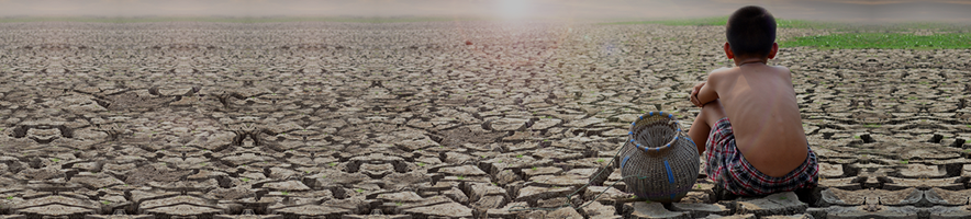
Via AGU Earth’s Futures publication, new research detailing the world’s arrival at ‘peak’ groundwater withdrawals:
Abstract
“Peak Groundwater” is the maximum withdrawal rate of groundwater from an aquifer system that precedes a decline in withdrawals resulting from aquifer depletion. This paper traces generalizable phases in groundwater-withdrawal regimes in individual aquifer systems and their associated impacts on eco- and geosystem services. The concept seeks to address common misunderstandings of fundamental concepts in hydrogeology, which have practical consequences for the management of groundwater systems that sustain these services. The Peak Groundwater concept highlights the critical need to acknowledge the nested character of transient groundwater flow systems and the effects of groundwater withdrawals beyond the aquifer boundary. Importantly, estimations of sustainable groundwater withdrawals need to consider indirect human-environmental risks of withdrawals, such as surface water depletion and land subsidence. Estimating acceptable steady-state limits for future groundwater withdrawals presents an “optimization challenge.” Solving this optimization challenge, estimating sustainable withdrawals for balanced groundwater budgets, is rooted in societal priorities and demands high-quality simulation models and monitoring tools and practices such as 4D monitoring systems that are complementary in type and scale. Recognition and prediction of Peak Groundwater can guide groundwater managers on how to operate within sustainable limits of abstraction. Proactive adaptive groundwater management can prevent Peak Groundwater and associated decline in withdrawal capacities.
Plain Language Summary
The concept of Peak Groundwater recognizes that there are limits to how much water can be extracted from wells and describes what happens within groundwater systems (aquifers) when water is extracted beyond these limits. Managing groundwater sustainably is challenging because every aquifer is different and data on complex system dynamics are often sparse. It also involves balancing (sometimes competing) environmental, social, and economic factors. To prevent overuse, experts are encouraged to determine sustainable groundwater withdrawals—the amount of water that can be withdrawn without causing long-term damage, like drying up rivers or sinking land. However, estimating sustainable withdrawals is complex and requires an understanding of how the underlying system functions. 4D monitoring, which tracks groundwater changes over time and space, is useful to plan ahead more effectively and helps predict delays in groundwater depletion effects. Data and models help decision-makers understand how water moves, how quickly it recovers, and when a system reaches a steady state. By using these tools, groundwater managers can predict when Peak Groundwater might happen and take steps to prevent future risks. The goal is to develop adaptive water management strategies that protect the environment and the communities that rely on safe water supplies.
Key Points
Peak Groundwater is the maximum groundwater withdrawal rate from an aquifer followed by reduced withdrawal rates caused by depletion effects
Peak Groundwater traces dynamic flow pathways across groundwater development stages with aquifer- and phase-specific consequences
Estimating sustainable withdrawals via 4D monitoring presents an optimization challenge beyond technical considerations
1 Introduction
Groundwater withdrawals are inextricably linked to the history of human development. Gaining access to reliable groundwater resources solved critical societal bottlenecks for safe drinking water and irrigation demands—fueling accelerated urbanization (Giordano, 2009) and food production around the globe, including the Green Revolution in Asia (Repetto, 1994; Shah et al., 2021; Shamsudduha et al., 2022). Today, groundwater continues to subsidize human livelihoods around the globe. Groundwater in the Anthropocene (Steffen et al., 2007), however, is undervalued and mismanaged—putting at risk the very services it provides to humans and the environment.
Accounting for approximately 99% of all liquid freshwater on Earth (UN Water, 2022), groundwater supplies half the world’s population with drinking water and around 40% of global irrigation needs (Siebert et al., 2010)—these percentages are likely higher (around 70%) due to groundwater’s indirect contribution to the baseflow of surface waters (Wood & Cherry, 2021). The “silent revolution of intensive groundwater use,” as coined by Llamas and Martínez-Santos (2005), was indeed a silent one. Although crucial insights have been gained with regards to understanding consumptive limits to resource use in general, for example, “Limits to Growth” (Meadows et al., 1972) and Planetary Boundaries (Rockström et al., 2009), limited attention has been paid to critical limits regarding groundwater withdrawals (OECD, 2015). The few analyses on withdrawal limits that do exist rely heavily on proxy-based approaches and lack ground-truthed data for calibration and validation (see e.g., Rockström et al. (2023)). Coined by Hulme (2011) as “climate reductionism,” discourse on climate change has arguably detracted global attention from a more holistic understanding of causes and effects of environmental mismanagement (Rigg & Mason, 2018), such as groundwater overexploitation. The exacerbation of freshwater scarcity (Damkjaer & Taylor, 2017; Taylor et al., 2013) through the amplification of climate extremes is one of the most direct impacts of climate change, putting groundwater management at the forefront of efforts to improve the climate-resilience of water supplies.
Notwithstanding the 2022 UNESCO WWDR Groundwater: Making the invisible visible, the lack of explicit attention to groundwater systems and their physical limits poses a critical threat to human livelihoods and the environment (UN Water, 2022). The concept of aquifer-scale Peak Groundwater presented here recognizes that groundwater withdrawals (Qg) can increase until the effects of depletion pervasively reduce well yields and well-water quality; the subsequent reduction in groundwater withdrawals follows a ‘peak’ in withdrawals (Figure 1). This concept is grounded in the science of an inter-connected water cycle (i.e., hydrology) and builds on the work of Theis (1940) stating that “all water discharged by wells is balanced by a loss of water somewhere”—with potentially negative impacts for dependent eco- and geosystems. As observed globally from piezometric data (Jasechko et al., 2024), peak scenarios are most common in dryland climates, where surface water boundaries often prove insufficient in balancing withdrawals through freshwater capture (C). The conceptual understanding presented here seeks to address the socio-economic challenges of freshwater scarcity that arise from dynamic physical-hydrogeological systems and to better inform transdisciplinary solutions to these challenges.
Concept of aquifer-scale Peak Groundwater including four phases of withdrawal capacities (rate = volume/time) and associated pollution (orange) and piezometry (blue) levels. The trajectory and relationships between withdrawals and groundwater/pollution levels will vary depending on context.
Building on the concept of Peak Water by Gleick and Palaniappan (2010) and its direct analogy to Peak Oil proposed by Hubbert (1956, 1971), we introduce the concept of aquifer-scale Peak Groundwater. The paper thereby expands on mechanistic explanations of peaks in groundwater withdrawals and crop production (Mrad et al., 2020). Here, we trace the evolution of groundwater withdrawals at the scale of the aquifer and define generalizable phases of groundwater development as a means to help identify associated management needs; this concept builds on aligned theoretical arguments developed by Cuthbert et al. (2023).
Groundwater management practices and effects are implemented and experienced at local levels of governance and can involve multiple development and management pathways based on collective action (Ostrom, 1990) and well-concerted supply- and demand-side interventions. Our intent is not to frame Peak Groundwater as an irreversible point of crisis, but rather as a signal of transition in the functioning and value of the groundwater system—one that can be physical, economic, or regulatory in nature. With nuanced attention to groundwater-flow system complexity, insights into the temporal evolution of groundwater use have the potential to raise the visibility of widespread groundwater mismanagement and inspire human agency for improved groundwater governance.
2 The Concept of Peak Groundwater
Can we run out of groundwater? Gleick and Palaniappan (2010, p. 11,158) argue that “the Earth will never run out of fresh water.” At the scale of an individual aquifer, however, groundwater resources can be depleted, their quality degraded beyond use, or the risks of continued depletion can exceed human-environmental costs. This paper provides nuance to Gleick and Palaniappan’s argument that transportability and associated financial costs are the main limiting factors to water security. When aquifers are depleted or polluted, finding replacements for the diminished resource can be impractical and insurmountable. While localized water transfers may, for example, provide important targeted relief to dense human settlements, large-scale bulk groundwater transfers face severe practical obstacles and consequences (e.g., pollution risks) and furthermore do not address local impacts of groundwater depletion such as the loss of groundwater-dependent ecosystem and geosystem services (Gorelick & Zheng, 2015; Griebler & Avramov, 2015; Kløve et al., 2011; UN Water, 2022; Van Ree & Van Beukering, 2016; Van Ree et al., 2017).
Gleick and Palaniappan’s (2010) concept of peak water differentiates between renewable and non-renewable peak water. Where renewable resources are largely flow- or rate-limited (such as surface water flows in rivers), non-renewable resources are frequently stock-limited and used as storage (Ehrlich et al., 1977). Groundwater resources can take both renewable and non-renewable forms with variable recharge rates that span a wide range of time scales from days to decades for shallower, more permeable groundwater systems (that can be considered renewable in a human lifespan), to much longer (even geologic) timescales for deep aquifers. Groundwater, however, holds particular importance as a stock-limited resource reservoir, importantly but not exclusively in drylands, where recharge rates are generally slow (MacDonald et al., 2021). This role as (non-renewable) storage gains further importance under climate change, where increasing hydroclimatic uncertainties, such as more frequent droughts and floods, are predicted to further increase the demand for freshwater from reliable groundwater reservoirs (Taylor et al., 2013). Comparisons between Peak Groundwater and Peak Oil, as defined by Hubbert (Hubbert, 1956, 1971), are insightful regarding the consumptive use of non-renewable groundwater (i.e., groundwater mining), where recharge rates are irrelevant for multi-generational human timescales. Critiques of the concept of peak oil have frequently targeted the predictive accuracy of peak oil, arguing that initial predictions ignored the diversification from oil as well as technological advances regarding its withdrawal (Bardi, 2019; Gorelick, 2011). Similarly, predicted timings for Peak Groundwater may be altered by technological advances (e.g., increased application of managed aquifer recharge), regulatory interventions (e.g., demand-oriented policies such as California’s SGMA regulation; California Department of Water Resources, 2020), or collective action (Ostrom, 1990; Sivapalan et al., 2014).
An important distinction between Peak Oil versus Peak Groundwater is that oil is never extracted at a rate that is replenishable by nature. In the case of groundwater, the goal of “good groundwater management” is generally to stay within a replenishment state and minimize negative effects such as surface water depletion, land subsidence, and saltwater intrusion. To stay within these limits, groundwater managers might enhance replenishment by artificially inducing recharge or by borrowing from storage in the short term (e.g., during dry years) and ensuring rebound occurs at a later stage (during wet years). In some respects, groundwater over-exploitation is economically self-correcting, for example, as water tables decline, lifting costs rise, making extraction less viable. Groundwater sources, however, differ in quality and pumping cost, giving rise to distinct demand-supply dynamics. While advancements such as cheaper energy or more efficient treatment technologies may delay the timing or soften the magnitude of a peak, they do not eliminate fundamental limits to groundwater availability. The concept proposed here identifies common aquifer-scale patterns of groundwater withdrawal rooted in the historical undervaluation of groundwater and the economic forces likely to shape future peaks in extraction. It can serve to estimate aquifer-specific timelines for recovery, and define new adaptive management pathways, where resources are managed within sustainable limits of abstraction.
We define four phases of Peak Groundwater that describe the evolution of groundwater depletion and associated withdrawal patterns through time (Figure 1). Phase 1 initiates resource exploration followed by increasing exploitation at increasing withdrawal rates (Qg) that are balanced by storage depletion and freshwater capture (C) where Qg < Cmax, wherein Cmax defines the exploited aquifer’s maximum rate of freshwater capture (Cuthbert et al., 2023). Intensification in this phase is facilitated by heightened demand, technological advances, and decreasing costs as production scales and gains in efficiency. Phase 2 observes continued exploitation with decreasing withdrawal intensities that, for example, decrease groundwater availability and increase costs limit withdrawal rates (Qg </= Cmax). Withdrawal rates peak and reach phase 3, where withdrawals decrease due to previous over-abstraction and resulting decreases in availability, affordability, or pollution of the resource (Qg > Cmax). Biophysical parameters and processes, such as low recharge rates or compaction effects, increase the likelihood of irreversibility of these effects. Continued withdrawals (Qg >> Cmax) can lead to phase 4, which tracks increasingly declining withdrawal rates. Facilitating reliable access to water resources in uncertain hydroclimatic futures, groundwater can be a catalyst for peace and prosperity (UN World Water Development Report, 2024, n.d.), or can fuel conflict among water users under conditions of increasing resource scarcity (Barnaby, 2009; Bhalla et al., 2025; Gleick & Shimabuku, 2023; Wolf, 2007).
Drivers of Peak Groundwater include groundwater abstractions for agricultural, industrial, municipal, and domestic use—with agriculture as the largest driver of groundwater depletion worldwide by far (Balasubramanya et al., 2022; Siebert et al., 2010). Effects are either quantity- or quality-driven or based on indirect risks on eco-and geosystem functions (Figure 2). Quantitative depletion leads to reduced withdrawal capacities due to higher extraction costs and/or resource availability (e.g., dewatering of the aquifer). Indirect effects of quantitative depletion may further include aquifer/aquitard subsidence due to pore pressure decline and consolidation of aquitards (geosystem effects). Qualitative depletion involves the pollution of groundwater resources through point source or non-point industrial/(sub)urban/agricultural groundwater sources (e.g., nitrates, PFAS, petroleum products, etc.) as well as upwelling from brackish/saline waters or seawater intrusion, which are particularly common in (but not limited to) coastal aquifers and are largely irreversible (Barlow & Reichard, 2010; Foster et al., 2018; Klassen & Allen, 2017).
(a) Flow chart of the concept of Peak Groundwater including chronology of cause and effects and the different management pathways groundwater decision-makers can pursue, with (b) corresponding timelines of groundwater withdrawals for given management scenarios. Direct effects are those that occur within the aquifer system and indirect effects are those that occur at the interfaces between the subsurface water system and human-biological systems that can be seen or measured on or above the land surface.
Peak Groundwater acknowledges that withdrawals are necessarily agency-dependent (Figure 2): Peak conditions are not deterministic but are the direct (or indirect) result of pumping decisions made by water managers and/or groundwater users. Beyond physical limits of withdrawals, decision-makers can choose to limit use based on economic, regulatory, or prosocial (collective action) considerations. In other words, under excessive groundwater depletion, withdrawal capacities will face a passive peak (i.e., resources can no longer be withdrawn at the same intensity as before), or water managers may decide to (re)actively limit withdrawals in order to prevent undesired direct and indirect effects (incl. economic consequences) of continued pumping such as land subsidence, sea water intrusion, or reduced ecological flows (Bagheri-Gavkosh et al., 2021; Galloway & Burbey, 2011; Gorelick & Zheng, 2015). It follows that in order to plan ahead, water managers need to understand aquifer-specific groundwater flow dynamics, the effects of withdrawals on these dynamics, and hydrologic system connections.
While groundwater management decisions must always be seen within wider regulatory and institutional frameworks and their given limits (Molle et al., 2018), a solid scientific understanding of the consequences of pumpage is the first step toward “good management and governance” of groundwater resources. This scientific understanding of well pumpage can and should be clarified in the framework of factors balancing well discharge. Well discharge (Qg) is initially balanced by some combination of increased recharge, decreased discharge, and volumetric depletion of groundwater stored in an aquifer (e.g., Cuthbert et al., 2023; Konikow & Bredehoeft, 2020); the natural rate of recharge does not enter into this balance (Bredehoeft, 2002). The first two factors constitute freshwater capture and include, for example, reduced baseflow to streams, induced infiltration from rivers due to reversal of hydraulic gradients, and reductions in evapotranspiration related to deepening water tables. The relative proportions of storage depletion and capture will change over time (Bredehoeft & Durbin, 2009): The depletion fraction can decrease with time whereas capture fraction can increase with time. If and when the depletion fraction reaches zero and all pumpage is balanced by capture (Qg = Cmax), a new steady-state is achieved and groundwater withdrawals become hydrologically renewable but are not as such “sustainable” (Table 1) as baseflow to streams and groundwater evapotranspiration ceases with dire consequences for groundwater-dependent ecosystems. If the aquifer is capture-constrained because of hydrogeological conditions at its boundaries, and a complete balance of pumpage by capture is not ultimately achievable, depletion will continue to grow indefinitely (Qg >> Cmax) and the total rate of pumpage is non-renewable (and unsustainable). But aquifers are finite so increasing pumpage will, at some point, decrease (either voluntarily or involuntarily) and a peak in rates of groundwater withdrawal will manifest.
Table 1. Definitions of Key Groundwater Science and Management Terms
Term
Definition (and source, where applicable)
Peak Groundwater
Maximum total groundwater withdrawal rate from an aquifer followed by reduced withdrawal rates caused by depletion effects
Freshwater Capture
Freshwater induced to drain to a pumping well as a consequence of changes in prevailing hydraulic gradients due to groundwater withdrawals; this involves changes in: a. groundwater recharge through the capture of evapotranspiration (ET) from the vadose zone or surface/shallow-subsurface runoff; and b. groundwater discharge through the capture of stream baseflow, evapotranspiration and/or exchanges with neighboring geological units (Cuthbert et al., 2023)
Groundwater Depletion
Decrease in available usable water due to long-term volumetric depletion (e.g. where groundwater withdrawals exceed freshwater capture), reduction in water quality (rendering use unsuitable due to natural or anthropogenic constituents), or a necessary reduction in withdrawals to prevent harmful external effects on eco- and geosystem services. Need to differentiate between initial volumetric depletion (necessary condition to develop an aquifer as a result of induced recharge) and chronic depletion (prolonged trend), jeopardizing withdrawal potentials for future generations (i.e. intergenerational inequity)
Optimization Problem
Calculation of a new (quasi-)steady-state for maximum sustainable withdrawals, where human and/or environmental benefits are maximized, and human and/or environmental risks/costs minimized. The full set of withdrawal impacts needs to be considered (i.e. simulated using high-quality ground-truthed monitoring data) and weighed against each other based on pre-defined societal priorities
Steady-State
Hydraulic condition for an exploited aquifer system, when the primary water table and potentiometric surface or surfaces are at a quasi-equilibrium, that is, non-variable over time. Here, the total withdrawal rate is effectively equal to the rate of induced recharge. This (quasi-)equilibrium state may include oscillations due to for example, seasonality effects. Withdrawal rates can be maintained in perpetuity. Needs to be continuously revised based on wider changes in land-use, climate, etc, which influence induced recharge
Time to Steady-State
Time required to reach steady-state based on hydrogeological flow characteristics, especially the conditions needed for induced recharge and reduced discharge (i.e. freshwater capture) to become the dominant flow characteristics balancing withdrawals. Long lags may need to be considered, particularly for confined aquifers
Renewable Withdrawals
Estimate of maximum renewable groundwater withdrawals that can be maintained in a hydraulic steady-state (different than sustainable withdrawals); this is the condition where groundwater withdrawals are equal to or less than freshwater capture. Withdrawals could be sustained in perpetuity (i.e. sustainability in the limited sense of resource sustainability), but do not consider associated human-environmental risks; this is equivalent to “flux-renewable use” of Cuthbert et al. (2023). N.B.: In some cases, renewable yields may not be feasible at all due to limitations in freshwater capture
Sustainable Withdrawals
Holistic estimate of maximum feasible withdrawals that maintain a hydraulic steady-state (i.e. renewable yield) AND limit human-environmental costs such as indirect effects on eco- and geosystem services (less than renewable yield). ‘The amount of groundwater one can withdraw without getting into trouble’ (Lohman, 1972)
Adaptive Groundwater Management
Decisions on groundwater withdrawals are continually revised based on high-quality ground-truthed 4D (i.e. three-dimensional flow system plus temporal dynamics) monitoring systems and models of groundwater quantity, quality, and indirect pumping effects. This continuous update of groundwater models with new monitoring data is referred to as the observational method and reduces prediction uncertainties of direct and indirect pumping effects and associated time lags. Withdrawals can be dynamically adapted to maintain steady-state conditions under future (natural and anthropogenic) system changes
Policy-based, economic, and technological levers can help to respond to, adapt to, or mitigate Peak Groundwater. These levers can be targeted at the demand- or supply-side of groundwater resources. As a supply-targeted intervention, Managed Aquifer Recharge (MAR), for example, can serve as a buffer of an impending peak in groundwater withdrawals. It is important to note, however, such interventions cannot extend groundwater availability ad infinitum. With 10 km3/year globally, MAR has barely reached 1% of global groundwater extraction and thus proves unable to keep pace with excessive groundwater abstractions (Dillon et al., 2019). Policy measures that target groundwater demand, such as the removal of subsidies for groundwater-intensive irrigation, can support the proactive reduction of withdrawals to stay within sustainable limits of abstraction. If stringently implemented, which often proves an institutional challenge (Molle & Closas, 2020; Molle et al., 2018), such measures can allow for withdrawal capacities to plateau pre- or post-Peak Groundwater (scenarios A-D in Figure 2). Examples of large-scale water re-allocation (e.g., China North-South transfer) can increase overall water availability but neither intrinsically prevent local Peak Groundwater nor its effect on eco- and geosystem services. In regions of limited groundwater recharge, such as drylands, preventing Peak Groundwater while continuing groundwater withdrawals may prove especially challenging. In such cases, groundwater mining needs to be accompanied by a rigorous evaluation (and where possible mitigation) of the negative consequences of groundwater depletion.
Phases of Peak Groundwater can be traced in unconfined, confined, and semi-confined (mixed) aquifer systems. The seemingly simple question of where does pumped groundwater come from proves remarkably challenging and necessitates a closer look at the spatiotemporal characteristics of a given aquifer flow system. In this paper, we illustrate sub-sections of simplified aquifer scenarios, which highlight critical hydrogeological processes in different aquifer flow systems, and trace characteristic phases and bulk properties of Peak Groundwater. Tracing these phases shows that at different stages of pumping, groundwater comes from different parts of the aquifer system with system- and phase-specific consequences within and outside the system boundary. It is important to note that the sub-sections illustrated here represent but a component within dynamic and nested groundwater systems with varying connections to surface water flow networks (Corson-Dosch et al., 2023; Fan et al., 2013) over a range of temporal scales.
In an unconfined aquifer (Figures 3 and 4), water table decline is a direct measure of changes in aquifer volume and saturated thickness. During initial pumping, water issuing from the well comes from depletion in the zone of head depression (drawdown) as a result of the compression/elasticity (squeezing) of internal porosity and drainage of water filled void space (Figures 3 and 4b). Continued pumping sources water mainly from drainage of the vadose (unsaturated) zone, decreased baseflow discharge, and reduction in evapotranspiration, forcing the drawdown of the water table and reducing aquifer thickness and transmissivity (Figures 3 and 4c). Peak Groundwater for an unconfined aquifer is the condition at which addition of more wells or more effective wells is limited by aquifer hydraulic constraints such that the total yield cannot be increased. For practical purposes, the aquifer has been partially dewatered, and more dewatering can take place but without an increase in the yield rate (Figure 3d). If the unconfined aquifer is hydraulically connected to a surface water body, such as streams, lakes or wetlands, the lowering of the water table causes the rearrangement of the groundwater flow system such that surface water bodies supply water to the aquifer and its pumping wells (i.e., transitioning from a gaining to a losing stream).
In monsoonal climates, heavy rain seasons can forge a long-term dynamic steady-state inhibiting peak conditions. The “Bengal Water Machine” provides a regional-scale example of this phenomenon in Bangladesh (Shamsudduha et al., 2022). Peak groundwater is the consequence of long-term transient flow that never achieves a dynamic steady-state (equilibrium) condition because withdrawals cannot be balanced by a combination of increased recharge and decreased discharge. Aquifer-scale groundwater depletion can induce deleterious impacts on terrestrial and aquatic ecosystems, as the water table is rendered out of reach for groundwater-dependent ecosystems or reduced baseflows can no longer provide water supply, adequately dilute pollutants or regulate in-stream temperatures (Griebler & Avramov, 2015; Jasechko et al., 2021; Kløve et al., 2011; Mukherjee et al., 2018; Schaller & Fan, 2009). Water-consuming phreatophytes, plants that can access groundwater directly through their root systems, may be threatened as the water table declines or proactively removed as a remedial measure against impeding peak groundwater.
Cross-(sub)section of an unconfined aquifer under temperate-humid conditions with lateral continuity showing stages of increased groundwater extraction from (a) baseline natural condition to (b) early-stage local capture and release from storage (i.e., lowering of the water table), to (c) expansion of the capture zone reducing in-stream baseflow, and (d) reversing the flux from surface water discharging to groundwater dramatically thereby impacting ecosystem and geosystem functions.
Cross-(sub)section of an unconfined aquifer under dryland conditions with lateral continuity showing stages of increased groundwater extraction from (a) baseline natural condition with low recharge to (b) early-stage local capture and release from storage (rapid lowering of the water table), to (c) increased focused recharge via leaky ephemeral streams, and (d) deep water tables disconnected from surface water with limited diffuse recharge potential.
In confined aquifers on the other hand (Figure 5), a decline in the potentiometric surface level does not directly relate to aquifer thickness/volume. The decline is, however, directly tied to the ease of groundwater withdrawal, as the energy required to pump groundwater from the aquifer increases with depth of water level in a well and increased lift (likely non-linearly). In confined aquifers, water yielded from wells comes from aquifer elasticity/compressibility (a reversible process), and/or from aquifer compaction/consolidation, which can permanently damage the groundwater flow system, including changes to hydraulic conductivity (K), storativity (S), and transmissivity (T). All confined aquifers by definition have a confining bed (i.e., aquitard) that releases water from storage during extraction and controls recharge rates to the underlying aquifer through aquitard or confining bed leakage.
Cross-(sub)section of a confined aquifer with lateral continuity showing stages of increased groundwater extraction from (a) baseline natural condition to (b) early stage, local capture and release from elastic compressibility, to (c) expansion of the capture zone increasing confining bed leakage and dewatering the overlying unconfined zone, and (d) dewatering of previously confined aquifer and release from irreversible compaction. Impacts on ecosystem and geosystem functions experience a temporal lag.
Groundwater pumping triggers a pressure change in the confined aquifer that propagates upward and leads to the redistribution of water flows across the aquitard and through the aquifer system. Although the time lag through low-permeability confining beds may be substantial, initial pumping comes largely from reversible aquifer elasticity (5.b) whereas continued pumping is likely to be sourced from irreversible compaction (5.c–d). Confining bed leakage increases as sustained pumping lowers the potentiometric surface (5.c) eventually leading to a water-table decline in the overlying unconfined zone. If the potentiometric surface falls below the top of the confined aquifer (5.d), the aquifer will start to dewater and convert to an unconfined aquifer in those areas. Where converted, the potentiometric surface effectively becomes a water table; water-level declines directly reduce the saturated thickness and transmissivity of the aquifer and, therefore, well yields – eventually leading to a Peak Groundwater condition.
Water re-directed from the unconfined zone to replenish the confined aquifer (5.d) is a type of capture that helps to balance pumpage against aquifer depletion. The effects of Peak Groundwater on the overlying unconfined zone and on eco- and geo-system services may experience substantial time lags; some of which may only be recognized long after well pumping has already been reduced or terminated. These complicate efforts to predict with precision their potentially harmful impacts. Such lags, which largely depend on the vertical hydraulic conductivity of the confining bed, are a universal phenomenon for all groundwater reservoirs but carry specific consequences and timings for a given system. If excessive pumping comes largely from aquifer system compaction rather than elasticity, excessive pumping can cause land subsidence. Where this is damaging to human settlements (e.g., infrastructure, etc.), land subsidence may be the driving force to reduce withdrawals—sooner than concerns of diminishing groundwater supply.
Groundwater pumping triggers the redistribution of water within transient recharge-discharge relationships (Bredehoeft, 2002)—with potential negative impacts for dependent eco- and geosystems. Withdrawals may increase aquifer recharge but, in turn, reduce evapotranspiration and surface water baseflow. Flawed assumptions of steady-state recharge rates contribute toward the so-called “water budget myth,” which ignores likely changes in recharge during capture or due to land use changes, climate, human interventions, etc. (Bredehoeft & Durbin, 2009; Cuthbert et al., 2023; Konikow & Leake, 2014). Pre-pumping “natural” recharge can therefore have little to do with induced recharge after pumping is initiated. Managing transient recharge-discharge relationships in a way that maximizes human and/or environmental benefit while minimizing human and/or environmental harm across the water cycle involves critical decisions on social-ecological trade-offs and is defined here as the “withdrawal optimization challenge.”
How can we define “sustainable” groundwater withdrawals? In terms of sustainability of the groundwater resource, the maximum rate of renewable withdrawals from an aquifer can simply be determined by the replenishment rate (i.e., induced recharge and reduced discharge), where the maximum achievable rate of pumping is maintained without further declines in the water table. In this new hydraulic steady-state, adjustments in recharge-discharge relationships account for the re-distribution of pumped water from other components of the water cycle. The maximum renewable rate of groundwater withdrawals (defined in Table 1), however, only refers to resource sustainability in the limited sense of sustained withdrawal possibilities and does not include considerations on damaging or disruptive effects in or beyond the water cycle. The optimization challenge within groundwater management aims to establish a hydraulic (quasi-) steady-state that limits human and environmental risks (i.e., sustainable withdrawals). Molle et al. (2018) describe this as a “trade-off that warrants a deliberative process whereby costs and benefits can be weighed in a balanced way, and the decisions made are explicit and transparent” (p. 447). There are infinite solutions to the groundwater withdrawal optimization challenge (i.e., multiple possible hydraulically stable states) where withdrawals differentially re-distribute water in the water cycle and where the primary water table or potentiometric surface ceases to decline. It follows that decision-makers need to determine which system components and services should be prioritized and choose appropriate and desired yields accordingly.
It can take years or decades before impacts of Peak Groundwater, such as effects on ecosystem (e.g., reduced baseflow in lakes, rivers, and wetlands) or geosystem services (e.g., subsidence in human settlements), are measurable (Kelly et al., 2013). Therefore, in order to estimate withdrawals that are sustainable for humans and the environment beyond the short term, it is important to establish long-term 4D monitoring systems (Patton & Rodney Smith, 1988) and simulation models (see descriptions of monitoring dimensions in Table 2) to understand the changing dynamics between key system components (Bredehoeft, 2005). 4D monitoring provides data to inform parameters, boundary conditions, and calibration targets to establish trained-and-tested models that can provide an understanding of the response of the “system.” Such holistic monitoring and modeling systems need to encompass dynamic properties of the aquifer as well as the aquitard to understand at what rate storage comes from what part of the water system in order to estimate sustainable withdrawal rates and the time required to reach steady-state (i.e., time-to-steady-state).
Table 2. Different Dimensions of Groundwater Data Differentially Reveal Information on Multi-Level Nested Systems
Dimensions
Description
1D
One-dimensional “water level” data (information can be illustrated in plan (top) view)
2D
Vertical profile of a well (depth-specific information on hydrogeological parameters)
3D
Multiple vertical profiles (information of nested heterogeneous aquifer system)
4D
Multiple vertical profiles monitored over time (information on nested flow dynamics)
One-dimensional (1D) “water level” data often lack system-specific information (Baird & Low, 2022) including but not limited to well type (see different water levels in different well types in Figures 3–5). The term “water level” is frequently and misleadingly used interchangeably for both (unconfined) water levels and (confined) potentiometric surfaces. For example, to understand if or where depletion is capturing water from, only the (unconfined) water table may be relevant whereas for potentiometric levels may be irrelevant (Figure 6). It follows, that the term “water level decline” should be avoided unless system-specific explanation is included. In a dynamic system, with rapid changes in land use and climate (see the Sahelian Paradox (Favreau et al., 2009) as an example), key aquifer flow parameters (4D) need to be continuously re-evaluated and re-defined to inform adaptive management decisions and sustainable withdrawals. We acknowledge that the proposed 4D approach to groundwater monitoring represents the gold standard of groundwater management and that, given practical limitations, resource managers are encouraged to make best (yet informed) use of incomplete or proxy data (e.g., OpenET satellite data). Adaptive groundwater management (Table 1) follows an observational approach and considers dynamic changes in climate and water availability (Elshall et al., 2020). Similar to the observational method in geotechnical engineering (Peck, 1969), effective groundwater management relies on iterative model improvements as new insights and data on changing hydrogeological flow characteristics become available: A piece-by-piece rather than trial-and-error approach. In the face of climate change, groundwater managers may realistically see themselves forced to deplete an aquifer during periods of drought, when water supply for human or environmental needs is critically at risk. Such decisions can be incorporated into adaptive management plans and not further threaten future water withdrawals, if the aquifer can be replenished in a reasonable period of time after the drought ends. If replenishment is not feasible, drought emergencies may nonetheless warrant depletion, in which case expected negative consequences (Figures 2–4) need to be acknowledged and incorporated in future aquifer management planning.
Mixed unconfined-confined aquifer system highlighting the limits of 1D groundwater data. If the aquifer is unconfined, the recorded water level is likely an approximation of the primary water table. If the aquifer is confined, water level is likely an approximation of the potentiometric surface for the aquifer. If the aquifer is semi-or locally confined, or includes multiple nested aquifer systems, there can be much complexity or uncertainty about what can be ascertained from blended, and therefore uncertain, 1D “water level” values for an entire aquifer system. Well profiles (2D) as well as the distribution and connectivity between these profiles (3D) need to be monitored through time (4D) to understand groundwater flow dynamics (i.e., where does water yielded from wells come from?) and to predict potentially deleterious pumping effects and their timing.
Can socio-economic benefits alone be sufficient to warrant chronic depletion of an aquifer along with its environmental costs? This is a political decision that needs to involve assessing various tradeoffs. For example, extensive groundwater use in the Southern High Plains Aquifer grew since the 1940s (essentially without regulatory or management controls), at rates that are arguably unsustainable (Deines et al., 2020) but transformed the region into an agricultural powerhouse with accompanying broad economic benefits. Should that magnitude of unsustainable groundwater use never have been allowed? Or did the benefits outweigh the costs? Groundwater science alone cannot answer such questions.
2.1 A Practical Example From Antelope Valley, California
Examples from developed aquifer systems illustrate the occurrence and consequences of Peak Groundwater. We offer an analysis of the alluvial aquifer system in Antelope Valley, California, which is a 2,400 km2 closed basin in an arid climate (average annual precipitation < 250 mm). Leighton and Phillips (2003) developed and calibrated a 4D numerical model to simulate transient groundwater flow and aquifer compaction for an 81-year period (1915–95). Siade et al. (2014) extended the model simulation period an additional 10 years. The data showed that total groundwater pumpage increased steadily from 1915 and peaked in 1951 at almost 0.5 km3/year, and diminished thereafter (Figure 7a). Konikow and Leake (2014) used the model results to compute recharge and capture fractions (Figure 7b), which was extended to incorporate the additional 10 years of simulation documented by Siade et al. (2014). This analysis showed that most of the pumpage derived from storage depletion during the first few decades of development but that the capture fraction only became dominant after the early 1970s. During 1988–90, annual withdrawals reached a post-peak minimum, and the depletion fraction reached zero during those 3 years. A new quasi-steady-state condition was temporarily achieved, and pumpage during that period (approximately 0.09 km3/year) could be considered renewable. However, groundwater use subsequently increased and storage depletion was again a contributing source of pumpage. After 2000, the capture and depletion fractions were approximately balanced (yet hardly sustainable given depletion fractions hovering around 0.5). For this aquifer system, it appears that the Peak Groundwater use was about five times greater than the renewable yield.
Groundwater stress and response in the Antelope Valley, California, aquifer system, showing (a) annual pumpage (withdrawal rate) and (b) nondimensional sources of withdrawn groundwater, including both storage depletion in the aquifer and capture of both surface water and evapotranspiration, based on numerical model developed by Leighton and Phillips (2003), extended by Siade et al. (2014).
Managed aquifer recharge started in Antelope Valley in 2010 (see avek.org/water-banking). This facilitated continued pumpage, as the increased recharge to the aquifer from water banking served as an additional source of capture. During 2016–2023 inclusive, with water banking operational, total pumpage averaged approximately 0.10 km3/yr with no net decrease in aquifer storage (Antelope Valley Watermaster, WWW, 2025).
The literature provides many examples of peak groundwater effects across the globe. For example, Jain et al. (2021) quantify the effects of groundwater depletion on cropping intensity in India estimating a 68% reduction in crop production in groundwater-depleted regions. Bhalla et al. (2024) trace the effects of chronic irrigation-driven depletion on income-poverty in Tunisia highlighting the effects of interacting social and institutional norms in post-peak agricultural transitions. Mrad et al. (2020) and Deines et al. (2020) present another case of peak groundwater from the High Plains aquifer, USA, where agricultural demands outweigh renewable water supply, necessitating a future transition from irrigated to dryland agriculture.
This paper serves as an invitation for researchers to conduct and publish further local case studies on Peak Groundwater to enhance evidence and better prepare societies moving toward or beyond peak water, in a more conscious acknowledgment of system limits and opportunities to operate within these limits.
3 Discussion
In 2003, the Food and Agriculture Organisation (FAO) of the UN stated that a global synthesis of groundwater knowledge and trends “would overwhelm a global exercise and the benefits would be negligible in comparison with the urgent local problems on which groundwater management has to focus” (FAO, 2003). Not surprisingly, the state of global groundwater data to date is still underdeveloped and unsuitable for addressing even more urgent global groundwater issues (UN Water, 2022). Despite advances in the state-of-technology of groundwater characterization, monitoring, and modeling (e.g., borehole geophysics, multi-level systems, continual pressure readings with sensors), the global state-of-practice in water supply management lags many years if not several decades behind these technologies. For example, while direct push real-time characterization methods are technically readily available to improve spatial resolution of contaminant transport assessments in aquifer systems, these methods are generally underused in practice. Meanwhile, groundwater data in global water assessment reports often remain one-dimensional (1D), aggregate, blended, or with sources simply not traceable (Table 2). Table 3 takes stock of the current state of knowledge and uncertainties in global groundwater data and models.
Table 3. Strengths and Weaknesses of Main Global Groundwater Data
Data types
Examples
Strengths
Weaknesses
Publications
Field-based data
IGRAC GGMN, borehole geophysics
Direct measurements (piezometry, carbon dating) with high accuracy, breadth, and depth (allows for 4D monitoring)
Often has limited spatial coverage; efforts to increase data availability may be labor- and cost-intensive
Does not in itself quantify dynamics (additional modeling efforts required)
Remote-sensed proxies (exclusively based on land surface models)
GRACE
Limited data needs, data freely available, large temporal and spatial scale, Density—temporal water content change
Can only capture volumetric depletion (Alley & Konikow, 2015)
All aquifers and their boundary conditions are unique; GRACE footprint too large: cannot detect volumetric depletion at small/local scales (Shamsudduha & Taylor, 2020)
Uncertainty regarding limited duration of GRACE measurements and application of uncalibrated, global-scale LSMs (Döll et al., 2014; Shamsudduha et al., 2012; Shamsudduha & Taylor, 2020)
Famiglietti et al. (2011); Rodell et al. (2009); Thomas et al. (2017), Scanlon et al. (2018)
Remote-sensed proxies (using land surface models and in situ observations)
GRACE
More accurate than proxies based on land surface models alone
See general GRACE weaknesses above
More work intensive than proxies based on land surface models alone
Ignores groundwater hydraulics and dynamics
Rodell et al. (2007); Shamsudduha et al. (2012); Swenson et al. (2008)
Crucially, it is important to note that increasingly prevalent remote-sensing approaches to groundwater monitoring, while valuable in detecting large-scale volumetric shifts in space and time, are insufficient when applied in isolation (see Rohde et al. (2024) as a recent example). Relying on large-scale gravity shifts observable from space, they cannot capture critical hydrogeological flow characteristics at a suitable scale on-the-ground that can predict direct and indirect effects of aquifer depletion (Alley & Konikow, 2015). In order to ascertain if continued withdrawals are sustainable for humans and the environment as well as to predict potential lags in these effects, it is necessary to investigate and forecast long-term hydrogeological flow characteristics, that is, where does groundwater come from at different stages of groundwater development (e.g., elasticity vs. compaction and depletion vs. capture). Given the quantitative and qualitative lack of groundwater data and data-sharing, we highlight the need for additional (raw) data-sharing in the global groundwater community as demonstrated by Jasechko et al. (2024) and institutionalized at IGRAC (International Groundwater Resources Assessment Center).
When high-quality information from measured field data is limited, it is crucial to triangulate data from different sources, clearly stating limitations and uncertainties that arise from using the chosen approach. Methodologies should build on complementarities of different methods to combine respective strengths and close uncertainty gaps and biases of each method being employed in isolation. Methodological complementarity can be two-fold: It can either be targeted at increasing precision and accuracy, and reducing bias at the same scale, (i.e., two data types measuring the same thing) or serve to bridge insights from different methods across scales whether spatial or temporal (Bairos et al., 2023; Parker et al., 2012). To increase precision and accuracy at the same scale, for example, borehole geophysical methods, such as acoustic televiewers (ATV), could be complemented by continuous core methods. To bridge methodological insights across scales, researchers may find it useful to turn to GRACE data to observe large-scale gravity shifts as an indicator for wide-scale volumetric depletion, which can then be explored using field-based 2D borehole geophysics (calibrated with 1D multi-depth profiles of hydraulic head and groundwater quality) and spatially connecting their depth-specific variability using 3D air-borne geophysics—finally animating their flow dynamics in 4D models.
There is a common saying among hydrogeologists: “We don’t know what we don’t know, and we can’t measure errors that we don’t know we’ve made” (Oreskes & Belitz, 2001). Generally speaking, uncertainty in groundwater monitoring and modeling remains widely unrecognized or unquantified in real-world contexts and increases with longer-term predictions (Bredehoeft & Durbin, 2009). Field-based groundwater data can reduce or uncover uncertainties in scenario modeling and can serve as important decision support tools to guide management and policy strategies (Bredehoeft, 2005).
How can data be used to effectively estimate sustainable groundwater use within changing recharge-discharge relationships? The quantitative analysis of Peak Groundwater, sustainable use, and temporal changes in depletion and freshwater capture require the development of a well-calibrated and well-documented numerical groundwater flow model with appropriately resolved aquifer properties and boundary conditions. Adequately solving the optimization challenge involves employing an observational method, monitoring groundwater parameters over various spatiotemporal scales, and refining conceptual models based on new empirical data. This observational approach to adaptive groundwater resources management relies on the method of multiple working hypotheses (Chamberlin, 1890; Elliott & Brook, 2007). Empirical data thereby serve the purpose of reconciling competing hypotheses that characterize different system attributes and can help groundwater scientists move from a conceptual model with ambiguity to one with more specific traits and constraints limiting the number of possible scenarios, thus reducing uncertainty.
A working conceptual model goes hand in hand with a numerical model (or suite of models) to integrate the many known conditions into a calibrated operating system. In this process, data are used: (a) as input parameters; (b) to calibrate; and (c) to verify the model through iterative observation (relying on different data sets for each of these steps). This purposeful pursuit of data strategically interrogates the unknown, so as to approximate the model to a fair characterization of the aquifer system. In other words, data are not collected for the sake of collecting data but rather specifically target the discovery of qualitative system attributes. Bredehoeft (2005) suggests that about a quarter of prevailing conceptual groundwater models are later rendered invalid as additional empirical data are uncovered, re-iterating the need to consider multiple working hypotheses and data-driven hypotheses testing as an integral component of (observational) groundwater monitoring and modeling.
How much data are enough? While continuous testing is necessary to minimize prediction uncertainties, the (“ideal”) resolution of data or models is subject to the degree of complexity of the system or the tolerable degree of uncertainty and impact associated with the predicted outcome. As aquifers undergo changes to their system (e.g., land-use and/or climate change), accompanied by changes in dynamic recharge-discharge relationships, it is essential to collect data at these phase changes to capture relevant changes in system properties and update predictive models accordingly. Additional non-hydrogeological data may need to be collected such as data on ecology, surface water hydrology, and land elevation based on context-specific risks of groundwater withdrawals. In many ways, applications of artificial intelligence (AI) in groundwater data science mirror the observational method, employing computational learning akin to iterative human learning. Like human-driven learning, AI patterning is bound by available data (“bad data in, bad data out”) and the limits of disciplinary knowledge. With or without AI, identifying, testing, and reducing the number of working hypotheses (i.e., contrasting and evaluating competing paradigms), strengthens predictive models and informs more reliable estimations of sustainable withdrawals.
Since optimization decisions are based on pre-defined priorities and values attached to water resources and related system functions, Molle et al. (2018) raise the important question of who defines these priorities: “Costs and benefits are inevitably weighed by the values and the social or political power of those concerned, which explains why costs tend to concentrate on weaker constituencies while benefits tend to accrue to more powerful actors. In other words, what is often considered a technical question in fact becomes a highly political question” (p. 447). The fact that water resources management is inherently political (Mollinga, 2008; Mollinga et al., 2007) underscores the need for transparent high-quality data monitoring systems that can provide evidence-based guidelines for management decisions. Adequate monitoring and modeling systems allow for the projection of future steady-states for imposed pumping conditions and can reduce potential arbitrariness in decision-making rules.
4 Conclusions
Across the globe, excessive pumping of groundwater resources threathens ecosystem functioning and the very services groundwater provides to communities worldwide. The task of defining key phases and characteristics of Peak Groundwater serves more than a technological function within the groundwater sector. It informs transdisciplinary responses with wider societal implications. The concept of Peak Groundwater, tracing dynamic flow pathways through different groundwater development stages, reveals the urgency in addressing the groundwater polycrisis that links, for example, drinking water supply, food production, ecosystem function, and land subsidence. Once a system has reached its peak withdrawal rate, damages to the aquifer system are often already so severe that economic and environmental consequences are either irreversible or exceedingly difficult to address. The severity of this societal burden highlights the importance of monitoring and early intervention to prevent a downward-spiral of systemic feedbacks. Local and regional/basin-scale data can collectively generate global insights on Peak Groundwater trends and associated impacts on current and future water supply for environmental and human needs. These can inform improved estimations of sustainable withdrawal limits and strategies for more effective groundwater management to mitigate the effects of groundwater depletion. Supply-side interventions, such as managed aquifer recharge, can provide temporary relief to groundwater scarcity by shifting the “peak curve” in space and time. The concept of Peak Groundwater as a “safe operating space” for groundwater withdrawals, however, continues to hold true even when supply is artificially increased.
The concept of Peak Groundwater is not deterministic, and does not predict a doomsday scenario for aquifers world-wide. Rather, Peak Groundwater highlights predictable generalizable phases of groundwater withdrawals under common (mis)management scenarios. Proactive adaptive groundwater management can prevent Peak Groundwater and the associated decline in withdrawals and advise groundwater managers on how to operate safely within limits of abstraction. Importantly, distinct hydrogeological conditions lead to distinct Peak Groundwater scenarios, which necessitate different management tools to address variable outcomes—based on holistic groundwater monitoring systems and adaptive forecasting. Importantly, there are also aquifers, most notably in tropical Africa, that remain largely under-developed. The accumulation of knowledge on peak dynamics worldwide can provide meaningful insights to decision-makers in regions that are still looking to intensify withdrawals.
This paper provides a holistic definition of groundwater depletion and discusses important reflections groundwater managers need to consider when estimating withdrawal rates that can generate (new) hydraulic steady-states within the limits of sustainability. By changing the position of the water table, recharge and discharge are re-distributed in space and time – possibly at the cost of other components of the water cycle. Solving the groundwater optimization challenge requires defined societal priorities and high-quality monitoring and modeling tools and practices (e.g., 4D monitoring systems) that are complementary in type and scale. This paper serves as an invitation to groundwater researchers and practitioners to share high-quality data for the diversity of hydrogeologic system conditions, which is needed to advance predictive models and inform evidence-based policy- and decision-making in nested (ground)water systems. In recent decades, the literature on nested polycentric systems in water governance has seen significant advancements (Mansbridge, 2014; Ostrom, 1990). However, analogous understandings for managing the biophysical aquifer system, particularly regarding nested groundwater flow systems, remain underdeveloped. Future research should recognize the overlapping and co-evolving nature of nested biophysical-governance systems, emphasizing the need for more holistic systems monitoring and modeling of social-ecological dynamics (Biggs et al., 2021).
Groundwater data are often scattered, insufficient, sources unknown, or plain wrong yet the issue of inadequate groundwater data must not serve as an excuse for inaction or failure to start anew to obtain necessary data. What local, regional, and global priorities can be defined based on available data sources? Underdeveloped data and models can provide an important guide forward (including but not limited to future data collection) and should be seen as an iterative process (Bredehoeft, 2005), where data, models, as well as resulting estimations of steady-state and imposed withdrawal decisions, are continuously reviewed and updated as new technologies and data are made available and new challenges arise. In conclusion, groundwater science, management, and policy remain urgent works-in-progress.
This entry was posted on
Saturday, October 11th, 2025 at
8:02 pm and is filed under
News. You can follow any responses to this entry through the
RSS 2.0 feed.
Both comments and pings are currently closed.