BLOG
March 3rd, 2009
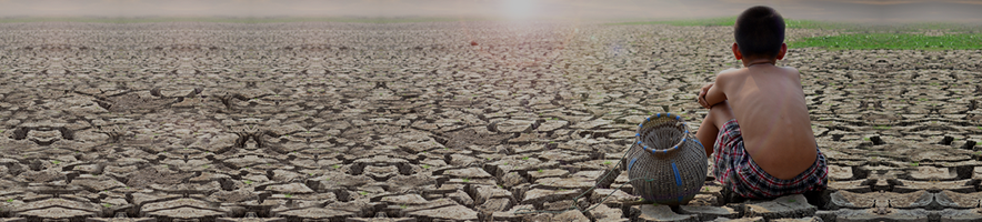
Via Registan, an interesting look at Lake Balkhash which – due to the international nature of the watershed, the development of oil in China and heavy industry on the its shores – may unfortunately be on track for a similar fate as The Aral Sea unless China, Kazakhstan and the other Central Asian nations work together. As the article notes:
Lake Balkhash lies in Central Asia, and is the largest body of water after the Caspian Sea, recently earning this status with the demise of the Aral Sea. Both the Aral and Balkhash lie locked in desert and semi-desert regions with little rainfall, fed largely by rivers running through heavily irrigated, arid regions. They are bodies of water with historically dynamic shorelines, vulnerable to a wide variety of actors in the region. The similarity of Balkhash and Aral suggests that a closer analysis of the cautionary tale presented by the disappearance of the Aral can give some indications as to the future of Balkhash. Being prey to many of the same factors that caused the desiccation of the Aral Sea, Lake Balkhash may soon suffer a similar fate. The permanent representative of the United Nations Development Program in Kazakhstan stated “…Lake Balkhash could meet a fate similar to the Aral Sea.†Though Balkhash exists largely in anonymity, it was not until its fishing fleets lay rusting in the desert that the Aral Sea came to worldwide fame and notoriety. This paper presents, in two parts, an analysis of the demise of the Aral Sea, listing those factors in common with Lake Balkhash, as well as those distinctive of each. The analysis of the Aral Sea’s demise in this paper will include only up to the fall of the Soviet Union. One factor is the social planning from which both Balkhash and Aral have suffered. The disastrously wasteful consequences from dam mismanagement and the civil engineering failed to consider natural requirements when figuring economic, industrial, and agricultural progress. Another factor is the impact of global environmental issues on the region, especially concerning the phenomenon of global warming. One more complicating factor is a system of inefficient irrigation practices servicing the demands of thirsty crops and urban development away from aquifers, and the pollution of rivers and groundwater with industrial waste and agricultural runoff. Following the analysis of the Aral Sea, this paper will illuminate those self-same factors that could lead to Lake Balkhash’s own disaster.
The many issues at work in the death of the Aral Sea are not all present in Lake Balkhash’s situation, and some are unique to the Aral Sea, as others are unique to Lake Balkhash. Moreover, some factors are quite intertwined, while a few are unaffected by the severity of others. The reasons for the disappearance of the Aral are still debatable, and this paper utilizes opinions of experts to compare the situation with Kazakhstan’s Lake Balkhash. Tragically, the government of Central Asia did not understand the importance of the Aral Sea until it began to disappear. During the Soviet Union, most civilians could not imagine the disappearance of the Aral Sea even as various party officials and policy makers included its eventual disappearance in their plans.- Aral Sea: An Overview
The name of the Aral Sea, which means “island,†is significant because the historic levels of the sea created thousands of small islands , hundreds larger than an acre in size. Others suggest that the island the name refers to is the water itself , an island of water in a sea of sand, surrounded as it is by the Kara Kum and Kyzyl Kum, two of the largest deserts in Central Asia.
The Aral Sea was once the fourth largest lake in the world, though its levels have changed dramatically over the millennia. It was roughly four times the size of Lake Balkhash in 1960. When geographers and historians refer to ‘historic levels’ with regard to the Aral Sea, they refer to the level of the sea in the early 1960s . During the first half of the twentieth century, the sea supported a thriving fishing industry, marsh and forest ecosystems. Compared with those levels, the desiccation has indeed been catastrophic.
Many factors have played a part in the Aral Sea catastrophe. Perhaps the most well known is cotton, as many journalists and scholars have lamented that the loss of the Aral was the price the Soviet Union agreed to pay to grow cotton in the deserts of Central Asia. In addition to the cultivation of thirsty crops like cotton and rice, the system of irrigation canals itself was a part of the problem. Woefully wasteful unlined ditches and canals lose much of their water to seepage and evaporation. In order to irrigate more land and provide electricity to growing communities, the Soviet Union built several dams in the area. These dams also played a part in the tragedy, creating several accidental brackish lakes in the desert, in essence stealing water from the Aral to dry up in the desert. The bureaucratic policies of the Soviet Union in turn affected these factors. Scholars have long lamented that the Soviet Union saw nature as expendable in the pursuit of progress, and the Aral Sea’s disappearance was just one part of the Soviet Union’s plan for the future of Central Asia.- Cotton, Irrigation, and Dam Mismanagement in the Aral Basin
Soviet farming practices in Central Asia were very different from Traditional methods of farming, to the detriment of local agriculture. Soviet farmers cultivated large, unbroken tracts of land converted from desert into arable land using large irrigation canals. Prior to Soviet power, sedentary Central Asian populations raised mostly food crops, on much smaller, labor-intensive small-plot farms with windbreak tree lines and individually maintained irrigation ditches. The irrigation system put in place during the twentieth century by the Soviet Union was unlined and wasteful, in contrast with tradition. Ancient irrigation systems unearthed by archaeologists were more efficient and effective than the local, modern irrigation and “investigations at Merv in southern Turkmenistan… indicate no evidence of soil salinization within the oasis despite many hundreds of years of irrigation. However, Soviet-built irrigation schemes resulted in widespread salinization and water-logging within 20 years of their introduction.†Advanced irrigation existed in ancient times, and “…the first descriptions of water management in Central Asia are provided in the works of the Arabic historians and geographers of the 9th–13th century… Their writings give very detailed accounts of water distribution and irrigation systems and it is evident that the administration of scarce water resources was central to the way in which the social and political hierarchy of settlements operated.â€
Central Asians were growing irrigated cotton prior to the Russian Conquest in the 19th century, but the Tsar, and the loss of cotton imports from the American South due to the American Civil War, influenced an exponentially increased cotton production in Central Asia. Whether called Transoxiana or Ma wara’un-Nahr , historians have long defined the watershed of the Aral Sea by the rivers that cross it – the Amu Darya and Syr Darya. Following the fall of the Russian Empire, the Soviet Union increased cotton cultivation, pushing water exploitation past the point of the ecological status quo and, beginning in the 1960s, the level of the Aral Sea began slowly to sink. Less and less water reached the sea, diverted to irrigation devoted to cotton, rice, and other thirsty crops, and the water that did arrive was laden with pollutants. . The Aral Sea had already begun to flee its shores when the fall of the Soviet Union transformed the issue from an internal economic issue into an international environmental catastrophe.
The Aral Sea is like a barometer, acting as the indicator of the health of the rivers that feed it . As such, it is the overall management of waters in the Aral Sea basin that has caused the grand scale of devastation, and not simply cotton growers in Karakalpakstan bordering the sea. However, the architects of this catastrophe have not significantly altered their water schemes away from cotton-based economies or the other causes of the depletion of the Aral Sea. Though the governments of Kazakhstan and Uzbekistan have begun to replace some acreage with less thirsty, non-“cash†crops, the old habits of Soviet agriculture persist. The Aral Sea was once a source of vast wetland and forest habitats, a habitat, a source of food, a homeland to the Karakalpak. However, that disappeared in part in the pursuit of ‘white gold,’ the cotton that helped clothe the people of the Soviet Union, and “the fish basket of Central Asia became the waste basket of the region, as a large proportion of the salts and agricultural chemicals upstream were deposited in the area.â€
The adverse consequences of social-communist planning exacerbated the situation, if not being the cause of disaster outright. Two principal elements illustrate this point: first, the building of dams for development and second, the continued spread of cotton cultivation. With dams, as with many forms of artificial developments to manipulate natural resources, the Soviet Union did not employ a cost-benefit analysis. Often, different departments of the Soviet bureaucracy were competing for benefits and recognition, building unnecessary dams to utilize a seemingly endless supply of water. For example, the unplanned Lake Aydarkul, which shifts from three to four thousand square kilometers, is large enough to be easily visible in satellite photography. Caused by poorly managed dams on the Syr Darya at the border of the Kazakh SSR and the Uzbek SSR, Aydarkul has been, since its birth in 1969 , a mixed blessing at best. Thanks to unscheduled hydroelectric flows, these brackish, shallow, and temporary waters sink into the desert, restored each winter, and growing with increased hydroelectric activity in independent Kyrgyzstan. Soviet mismanagement created a similar situation on the border of the Turkmen SSR and the Uzbek SSR with the waters of the Amu Darya filling Lake Sarykamysh. Sarykamysh is a drainage collector of salty irrigation runoff, and currently covers more than three thousand square kilometers. Like Aydarkul, dams stop water traditionally headed for the Aral Sea, which instead drains into Sarykamysh. Aydarkul and Sarykamysh lie in salt flats far from cultivated lands, and the water trapped there is lost to economic use, unable to reach its original destination, an enormous waste.- Aral Sea: Political Considerations
The former Soviet Union never based its water management scheme on maintaining equal trade of resources between the republics, and Moscow dictated all terms. For example, the central location of decision-making meant that while Kyrgyzstan and Tajikistan let flow away their primary valuable resource, GosPlan in Moscow compensated them with subsidized fossil fuels, along with the benefits of the socialist system. The Soviet Union allowed the rampant disregard for natural cost that caused the catastrophe, but perhaps it was the fall of the Union in 1991 and the rise of border checkpoints that pounded the final nail in the coffin for the Aral Sea. Inter-regional inequalities and failed and unrepentant Soviet-style governance dashed any hope of unified efforts to conserve and restore the sea.
- Lake Balkhash: An Overview
Lake Balkhash is of a different type than the Aral Sea, and its name reflects that stark contrast. Its name in Kazakh [Балқаш (Balqash)] derives from the word for “muddy.†Lake Balkhash’s water levels are historically very elastic, rising and lowering more than a meter from decade to decade. Unlike the Aral Sea, Balkhash has historically been very shallow, fed by minor rivers from the Dzungaria Plateau of Northwestern China and the Semireche region of southeastern Kazakhstan. Exact measurements of Balkhash’s current surface area range from 16,000 km2 to 18,200 km2. Balkhash has recently become the largest single body of water in Central Asia after the Caspian Sea . Lake Balkhash has an average depth of only 5.8 meters, and a maximum depth of 25.6 meters. Its eastern and western halves are quite different – the eastern being deeper and saline. Balkhash is located entirely inside one country, the Republic of Kazakhstan. However, the Balkhash watershed includes the Ili River, which rises in China’s Xinjiang Autonomous Region. Fifteen percent of the basin’s area lies inside China, including the glacial river sources of Balkhash .
Various organizations are warning that that is exactly what could happen if current policies and plans continue. If Balkhash disappears, it will be the result of a line of naturally destructive developments begun in the Soviet Union and continuing in the present day in northwest China.
The Ili River, rising in China, provides between seventy-five and eighty percent of fresh water inflow annually. Because the lake is shallow, more of its volume is susceptible to evaporation. Together with the smaller size and shallower depth, this makes Balkhash vulnerable to environmental change. Balkhash was roughly half-fresh water and half-saline in the 1960s, but the saline boundary has shifted south in recent history, the salinity increased due to artificial causes. The building of the Kapchagay dam and reservoir retarded the inflow of the Ili River, allowing the advance of northern brackish waters far enough south to affect the large industrial city of Balkhash, located halfway up the Western shore.
Lake Balkhash is in danger for a variety of reasons. Similar to the Aral Sea situation, some of these factors are agricultural. Rivers flowing to Balkhash feed an inefficient irrigation system watering cotton and rice cultivation. In addition, dam building during the Soviet Union has played a part in desiccation of the area. However, unlike Aral during the Soviet era, Lake Balkhash is dependent on state-to-state cooperation, as a majority of the water in Balkhash comes from the Ili River and China. In addition to the Soviet legacy of development, similarly exploitive social planning exists in northwestern China. Finally yet importantly is the threat of global warming, which threatens Lake Balkhash. Independent of Chinese development, the disappearance of the glaciers of the Tien Shan and Central Asian mountain ranges would drastically change water reality for millions of people.- Irrigation, Dams, and Balkhash
Kapchagay reservoir is a symbol of progress and recreation for Kazakhstanis living in Almaty. The Soviet Union made initial development plans for the reservoir in the early 1960s . The new dam, according to GosPlan, would make it possible to irrigate an additional million acres, more than half of which would be devoted to rice. Fish bred behind the Kapchagay Dam would increase productivity, and water transportation would lower shipping costs – it seemed a win-win situation to GosPlan in Moscow. The dam would soon pay for itself.
Over the course of its construction, lake levels dropped significantly. Two small lakes to the southeast of Balkhash completely disappeared, along with valuable wildlife habitat. Water logging and salinization continue to be major issues connected with Kapchagay, thanks in part to the level of irrigation necessary for rice cultivation.
Kazakh SSR scholars began to protest the building of the dam because, due to its shallow depth, arid location, and rapid evaporation, the eastern end of the lake was susceptible to the environmental stress the dam would have caused. In the 1960s, residents of Balkhash, the industrial city on the center of the western shore, “began to realize that the flow of the Ili would be seriously disrupted when it was blocked to fill the Kapchagay reservoir. The diversion would mean a reduced flow of fresh water into the lake. This, in turn, would lead to an increase in the lake’s salt content and the poisoning of the town’s fresh water supply.†Protests led to the discovery that the Ministry of Power independently devised the Kapchagay Dam, and GosPlan in Kazakhstan had officially questioned the act as early as November 1964, six months before Moscow received the plans. The Ministry of Power had drastically overestimated agricultural returns while acknowledging that the dam would halt the spring floods that hydrated the delta area. Without those floods, the land reverted to desert in only two years. The Ministry of Power consequently emphasized the benefits of added electrical capacity and the creation of a recreational area close to the capital of Alma-Ata [present-day Almaty]. “Neither the recreational value nor the power potential was even mentioned in the 1965 plan. Furthermore, once construction had been approved, another calculation was made and it was discovered that it would take four, not 1.5 years for the dam to pay for itself.†The Ministry of Power secretly raised the proposed height of the dam. The reservoir filled ahead of schedule, the salinity of the water near Balkhash rose 8% in just the first year, and the level of the lake slowly descended.- Lake Balkhash: Political Considerations
Unlike the Aral Sea, Lake Balkhash’s political factors connecting Kazakhstan with its powerful neighbor China complicate the issues of water management, dams, and irrigation. Aside from the Soviet legacy, China is building even more dams along the rivers feeding Lake Balkhash. China’s oil industry is booming, and the oil industry is particularly thirsty, and located entirely in the upper reaches of the Ili River basin. The oil boomtowns, supplied with water that traditionally flowed to Lake Balkhash, grow every year. Ironically, thanks to increased glacial melt caused by global warming, Lake Balkhash has not shown any losses in the last several years, and even minor gains. This has lulled many into a false sense of Balkhash’s environmental security and safe future. Its safety and security are certainly in question, as one official claimed that the government’s goal is to retain three times the water drawn in 2007 from the Ili. Such an amount would seriously affect the levels in Kapchagay Reservoir. The impact of such an event is difficult to predict, as Kapchagay is the source of water and electricity for Almaty, Kazakhstan’s largest city.
One issue is the decreased water available when upstream developments call for more water, impinging on downstream consumers. China is putting more land under irrigation every year. Both Kazakhstan and China view water as “God’s gift,†making it vulnerable to a ‘first come, first serve’ style of management. Kazakhstan may find itself asking China for ‘Chinese’ water to preserve Lake Balkhash. Stalemate continues as the Kazakhstan government strive to maintain the status quo . Pricing the water may yet offer a solution, though one with its own set of problems. “In spite of its vital importance to agriculture, water in the Central Asian region has largely remained unpriced, or has been priced at a purely symbolic level.†However, to maintain the current status quo between China and Kazakhstan, the loser will be the level of Lake Balkhash. The Regional Environmental Centre for Central Asia (CAREC), a Kazakhstani NGO, produced a draft agreement between Kyrgyzstan, Kazakhstan, and China regarding water resource sharing in 2007 , but without the political connections to bring the parties to the table.
Even as Nazarbaev hopes to make Kazakhstan one of the top 50 most powerful countries in the world, China has the more attainable goal of being number one. Kazakhstan recently built an oil pipeline to export at market prices . “The current economy is developing under conditions of increasing water deficiency. In spite of increasing efforts by the governments of the countries in the region, and by the international community, the situation in regard to water supply and economic objectives in the countries of Central Asia remains tense and shows clear tendencies towards aggravation and conflict.†However, this gives Kazakhstan little political capital, as it needs Chinese oil imports more than China needs Kazakhstani oil. A frank look at the statistics drives the inequality home, with Kazakhstan’s entire population able to fit into a single large Chinese city. In short, China’s population and economic pressures are serious issues for Kazakhstan. Raising the water issue with the River Ili and Lake Balkhash would increase tensions with China’s plans in the Xinjiang Autonomous Uighur Region, earmarked for rapid industrial and agricultural development over the upcoming decades.- Local Consequences of Global Warming Trends
Recent years have seen a record amount of water race down the Ili from snowmelt and glaciers in China, masking the increase in water use. Glaciers are retreating and the continental climate is becoming extreme in Central Asia. Along with the Alps, Central Asia has seen some of the most drastic glacial disappearance anywhere in the world. The future of Lake Balkhash, not to mention the millions that depend on water destined for that body of water, depends in large part on those glaciers. While this has led in some cases to record highs in local reservoirs and incremental increases in Lake Balkhash, it speaks of a problem several orders of magnitude more severe than mismanagement or water rights disputes. While precipitation and groundwater feed some of the Balkhash basin, glacial waters and snowmelt are a large percentage that, if removed, would bring unforgiving ecological and economic consequences.
The desiccation of Lake Balkhash would initiate an environmental downward spiral. “This would lead to longer, hotter summers with increased crop water needs and heightened irrigation requirements, which could in turn reduce aggregate water savings from irrigation improvements.†A drying Balkhash would expose thousands of square miles of sand and salt, to say nothing of the industrial waste from the city of Balkhash, to winds that would carry them into the remaining glaciers of the Tien Shan, accelerating the melting process.
The disappearance of Balkhash would have wide-ranging effects, including on the local population . However, the concerned countries’ economic policymakers see Lake Balkhash as a holder of idle resources. The Soviet Union generally did not include the ‘idle’ natural uses of water resources in its analysis , and China is likely to repeat the mistake of not allocating water to natural reserves alongside agricultural, industrial, and personal use. The fact is that large bodies of water lower air temperatures, store winter warmth and normalize the extremes of the continental climate of the Asian steppe. Since the disappearance of the Aral Sea, winters have been colder and longer, summers hotter and drier, and dust storms far more frequent.- Conclusion
In conclusion, the Aral Sea is mourned as an ecological disaster, and even more so as one wholly preventable and caused by chronic mismanagement, unashamed exploitation of nature, and exacerbated by an inefficient economic system. The Balkhash issue is one that can draw many comparisons with the Aral Sea, and many of the same factors are at work. This paper has covered some of them: the consequences of environmentally unsound social planning, the increasing seriousness of global warming, and the repercussions of faulty irrigation. Some other issues are unique to Lake Balkhash, like the international nature of the watershed, the development of oil in China and heavy industry on the shore of Lake Balkhash. The lost sea has a lot to teach the world about the upcoming crisis with Lake Balkhash. The health issues raised by Aral should be enough to give Kazakhstan pause. Increased cultivation of rice and cotton in the Ili River basin seems too obvious a form of déjà vu, especially when combined with a devil-may-care attitude towards the pollutants dumped into Lake Balkhash by the industries in the city of Balkhash. Lake Balkhash, which is disappearing when Central Asian governments should have learned their lessons already, is an issue for serious consideration in China and Kazakhstan.


