BLOG
January 2nd, 2024
Via The Hill, commentary on a grand plan to save the Rio Grande:
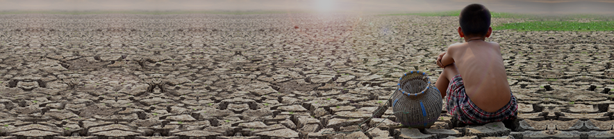
America’s rivers are integral to our country’s natural heritage and economy — and they’re drying up at an alarming rate.
Already strained by decades of excessive water use, mainly for irrigation, once-thriving waterways now face the added pressure of climate change. Particularly in the West, amid the driest conditions seen in over a millennium, water shortages are threatening farmer livelihoods as well as U.S. food security. These cultivators of the land face an existential threat: adapt or witness the end of centuries-old farming legacies.
But all is not lost. Our research, recently published in the Journal of Water Resources Planning and Management, shows that by embracing change we can preserve the livelihoods of America’s farmers, the health of our ecosystems, and the stability of food production for future generations.
Globally, rivers are buckling under the weight of human demands for water. Agriculture alone accounts for more than 80 percent of all fresh water consumed, a staggering figure that underscores the predominant role irrigation plays in shaping the condition of these waterways. The plight of the Rio Grande, also known as the Rio Bravo in Mexico, is a microcosm of a ubiquitous challenge: rivers worldwide are contending with the dual threats of overuse and climate-induced scarcity.
Imagine the Rio Grande as it once was — a mighty river traversing 1,900 miles, its flow coursing from the Colorado mountains to the Gulf of Mexico, pumping life into diverse ecoregions and sustaining over 16 million people across two nations. Most of the Rio Grande’s natural flow has been siphoned, bit by bit, by the needs of agriculture and cities, and today the Rio Grande is designated as one of the world’s 10 most endangered and water-stressed rivers.
This drying of the Rio Grande, known as flow depletion, is driving farmlands out of production and numerous species to the brink of extinction. But before we can offer up viable solutions, we need a better understanding of the extent of the problem.
To assess how much the natural river flow has been altered, we developed what is, to the best of our knowledge, the first basin-wide hydrologic model of the Rio Grande/Rio Bravo, which showed the flow in many areas of the river is more than 80 percent depleted for significant portions of the year.
Our model enabled us to determine the difference between how much water still passes downriver and how much it needs to retain to sustain healthy ecosystems along its corridor. Closing these “environmental flow gaps” became our objective, and by using our model as a screening tool, we were able to look at each of the river’s subbasins and identify how much water was needed to restore the river’s health.