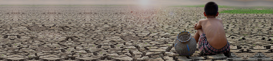
To ensure that the Colorado River can remain a lifeline for 40 million people, the federal government is looking for answers in the extremes of the distant past and the warnings of a hotter future.
Despite significant rainfall in recent months, Lake Mead could return to near-historic lows by 2025. As the Bureau of Reclamation looks to reach a deal by the end of the year — before a potential change in administration — the agency is, for the first time, putting climate change at the center of how it’s planning the future.
Those who rely on the river are now testing water-sharing strategies with the agency’s new web-based tool that harnesses more than 8,000 possible futures of the river to see how policies stand up against the wild swings and uncertainties brought on by the warming climate.
“We ultimately get a very wide range of conditions that could happen under climate change,” Rebecca Smith, a Reclamation official, said during a November seminar. “And scientists don’t expect that to be narrowing anytime soon.”
The force driving this innovation is a chilling one: Policymakers’ recognition that the way they’ve forecast the river’s future no longer works.
By relying on records of the river’s flow over the last century, the federal government and western states repeatedly underestimated the drought and failed to keep major reservoirs from nearing dangerous levels that could threaten the water supply for millions of people. Over the years, Reclamation has looked to climate science to solve the real world problem of a shrinking Colorado River, according to river experts and people involved in the effort. Even so, the deals struck with states over the past two decades to cope with the drought did not incorporate climate change models into the simulations of the river used to set long-term policy.
This is changing now. Reclamation’s new approach will test policies against a future informed by climate models that project warming to continue, as well as tree ring records of ancient droughts far worse than anything in the recent past — incorporating a much wider range of possible river flows than available in the recent historical record.
“We’re teetering right on the edge here of being able to say, yep, climate change models are a part of our decision-making,” said Terry Fulp, who spent three decades with Reclamation, including eight years as the Lower Colorado River Basin regional director until retiring in 2020. “It’s been a long time coming.”
To do this, a wonky band of government officials and academics are diving into a new world of unpredictability.
Their approach is called “decision-making under deep uncertainty” and it throws out the notion that anyone can predict what the future flow of the river might be — a strategy that led to Reclamation being in a “crisis management mode,” said one official not authorized to speak publicly.
The most recent crisis eased about a year ago. The nation’s second-largest reservoir, Lake Powell, nearly dropped to the point where its hydroelectric dam could no longer produce power. It was saved by an unusually wet winter — and a short-term deal with states to conserve water in exchange for billions in federal money. But scientists warn that renewed drought could quickly threaten the region again.
“Last year was maybe the anomaly,” said Tom Buschatzke, director of the Arizona Department of Water Resources.
Rethinking past assumptionsWhen Fulp joined Reclamation in 1989, the future of the Colorado River was planned on a single computer in a suburban Denver office building.
The lumbering mainframe at the Lakewood office took up an entire room and slowly churned out rows of numbers on perforated paper — a simulation of how the most important river in the West would be distributed among its dozen major reservoirs for years into the future.
The only people who could use this model — known as the Colorado River Simulation System, or CRSS, were federal government water managers such as Fulp. And to make tweaks required rewriting its code in the now-archaic computer language called Fortran. It was, Fulp recalled, “really cumbersome.”
In the early 1990s, Fulp teamed up with academics at UC Boulder’s Center for Advanced Decision Support for Water and Environmental Systems to develop software known as RiverWare and a version of the CRSS model that could be used by others reliant on the river, from states and cities to farmers and tribes.
In the Colorado River basin, the states were competing more for water; new federal environmental laws required comparing alternatives before making resource decisions; and many distrusted the federal government.
“They all hated Reclamation,” recalled Edith Zagona, a former Reclamation official who directs the UC Boulder Center. “We had to prove to them that this newfangled software could work. They didn’t want anyone pulling a fast one on them.”
Over the years, the software and the models running on it became a fundamental tool for settling disputes, avoiding litigation among rival parties and reaching agreements on how the water could be stored and distributed. It’s used on several major rivers in the United States, including the Columbia River and the Rio Grande.
The CRSS model simulates the flow of water through canals, pipelines and reservoirs as the Colorado traverses 1,450 miles, seven states and two countries — from the snow-capped peaks of the Rocky Mountains to the Sea of Cortez. Programmed into it are the rules that govern who gets priority access to that water — the complex web of regulations, statutes, treaties and court cases that date back more than a century, known as the Law of the River.
It can reveal how changes in water supply, demand or the policy environment will impact issues including reservoir levels, hydropower production, flood control or protecting the endangered fish that swim through the Grand Canyon.
To run it, water managers must estimate the streamflow entering the river system. Since the model was first developed, they’ve based this on what had been observed on the Colorado River dating back to 1906.
Scientists knew this period included very wet years in the 1920s, when the western water sharing deal was forged, and in the 1980s, when Lake Powell almost overflowed the Glen Canyon Dam. But the 20th century record was seen as the best way to understand what the river was capable of doing.
“It was almost universal in water planning: the assumption that the future would look like the past,” said Jeff Lukas, a climatologist and Colorado River researcher.
But after the drought started in 1999 — and Lake Mead and Lake Powell commenced their long decline — there were growing doubts about the usefulness of the 20th century record. One major warning came in the form of tree rings.
The rings inside logs, stumps and standing dead trees told a much older story of how much water was available in the Colorado River basin. Researchers in 2007 created a record that dated back to 762 A.D. that revealed punishing Medieval droughts, including a 62-year dry stretch in the 1100s that produced streamflows lower than anything in the 20th century.
With levels at Lake Mead and Lake Powell dropping from nearly full, in 2000, to about half full five years later, Reclamation and the states negotiated an agreement over how to operate the reservoirs as they declined — and how shortages would be divvied up.
In 2007, the modeling predicted a zero percent chance that Lake Powell’s elevation would fall to the point that it couldn’t help produce power by 2026. Last year, states struck an emergency deal to make unprecedented cuts in water use to avoid that very fate.
Charting the river’s futureIn 2012, after a decade of drought, Reclamation published a major study assessing the health of the Colorado River and what the warming climate would mean for its future.
It wasn’t a simple answer. The leading global climate models needed to be adapted to the Colorado River region — where topography in the Rocky Mountains varied widely — then combined with other models to estimate stream flows. While the results consistently projected higher temperatures for the region, with less snowpack in the Rockies and more frequent droughts, it was — and remains — less clear how much rain and snow would fall each year.
“The precipitation part of climate model output is not good,” said Brad Udall, a water and climate scientist at Colorado State University. “It still continues to have problems, especially on a regional basis, getting things right.”
A Rand Corp. scientist named David Groves, who had been hired to help on the 2012 study, saw this uncertainty as an opportunity to rethink how river modeling was done. Instead of trying to make possibly incorrect predictions about what the Colorado River would look like in the future, he and his colleagues advocated to test different river management strategies against thousands of possible futures of the river derived from a wide range of sources — the tree ring record, climate models, the historical record — to see how well they held up.
At the time, such intensive computer modeling was slow. In November 2014, Groves convened a group of Colorado River stakeholders at the Lawrence Livermore National Laboratory in California to show how the lab’s supercomputers could accelerate the process. He tested policies against 12,000 river scenarios — something that would normally take six weeks.
“While we fed them lunch, we ran the supercomputer and it did the whole analysis in an hour,” Groves said.
Back then, he said, there were plenty of ominous possible outcomes in his analysis, including that Lake Mead would disappear if consumption patterns continued.
“People saw it and it worried them,” Groves recalled. “But even if someone says this is what could happen, you can still say, ‘Well, that’s far off.’”
By the fall of 2022, Lake Mead and Lake Powell were just a quarter full. And Reclamation was predicting a more than 50 percent chance these lakes would drop below critical thresholds without further action, although forecasts are now less dire.
Trying to avoid disasterThe new web tool, built by Virga Labs, a water consulting firm, in partnership with Zagona’s center and Reclamation, is the culmination of years of work on the science of “decision-making under deep uncertainty.” It uses cloud-computing to run the CRSS model in thousands of variations in ways that haven’t been possible in the past, said Virga Labs chief executive Season Martin.
But the tool also represents a more fundamental change in how Reclamation looks at the problem of a dwindling Colorado River. Instead of trying to assign probabilities about future risk, the agency aims to test different ways to manage the river against the widest possible range of river scenarios — and see what works best to avoid disaster.
“We want to know that things are going to be okay even in really challenging conditions,” Smith, the Reclamation official, said in November.
Buschatzke, Arizona’s top water official, called the new modeling tool a “very positive step forward,” because it allows people or entities without the technical expertise to explore changes in river management. But he expects his agency to continue to run numbers and test strategies the old way, as well.
“We’ve spent enough time and effort learning how to do it,” he said.
Reclamation said it will also use other analytical methods it has relied on in the past as it assesses the proposals that states are expected to present in March on how to share a river stressed by climate change.
Not everyone is confident this new approach will deliver better results — or keep reservoirs from running dry in the future.
Udall, the Colorado State University scientist, said sophisticated new tools may give the illusion of being able to find a safe path forward for a river whose natural flow is down 20 percent in the past two decades. Simply cutting the amount of water states can take by a big amount may be wiser, he said.
“I think we get too clever by half with all this technology,” he said. “I think you can make this process a whole lot simpler. Which is we need to plan for a lot lower flows, and let’s not hide behind or obscure some of these tough details with really complicated models.”